Search Results
Filter
Cultivation/Extraction
Plantation/Forestry Area
Remove constraint Cultivation/Extraction: Plantation/Forestry Area
Land Features
Jungle/Wooded Area
Remove constraint Land Features: Jungle/Wooded Area
Language
English
Remove constraint Language: English
11 Results found
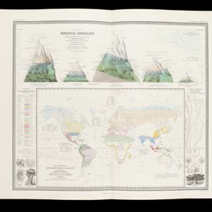
The geographical distribution of plants according to Humboldt's statistics of the principal families and groups: Schouw's twenty five phyto-geographic regions, and the distribution of the family of palms and the genera Pinus (pine) & Erica (heath)
1849
Brunei, Cambodia, East Timor, Indonesia, Laos, Malaysia, Myanmar, Papua New Guinea, Philippines, Singapore, Southeast Asia, Thailand, Vietnam
- [remove]Jungle/Wooded Area11
- Mountain/Volcano6
- Wetlands5
- Mangrove1


