Search

Search Results

A map of British North Borneo

event1899

location_onMalaysia, Brunei, Indonesia

The colonial territories of British North Borneo are shown in pink on this late 19th century map, with Brunei and Sarawak in green, and Dutch colonial territory in yellow. Sea routes around the British Empire are depicted on an inset map.

A map of British North Borneo

event1894

location_onMalaysia, Brunei, Indonesia

The colonial territories of British North Borneo are shown in pink on this late 19th century map, with Brunei and Sarawak in green, and Dutch colonial territory in yellow. Sea routes around the British Empire are depicted on an inset map.
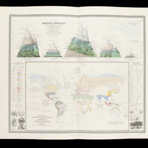
The geographical distribution of plants according to Humboldt's statistics of the principal families and groups: Schouw's twenty five phyto-geographic regions, and the distribution of the family of palms and the genera Pinus (pine) & Erica (heath)

event1849

location_onBrunei, Cambodia, East Timor, Indonesia, Laos, Malaysia, Myanmar, Papua New Guinea, Philippines, Singapore, Southeast Asia, Thailand, Vietnam

World map showing the distribution of plants, including in Southeast Asia (e.g. Areca catechu (betel tree), Calamus, Caryota urens, Altingia, Pinus Dammara (Amboina pine), P. sinensis). With data on plant growth in different temperature zones.

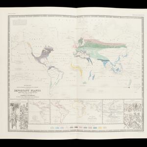
Survey of the geographical distribution and cultivation of the most important plants which are used as food for man: with indications of the isotheres & isochimenes, or lines of equal summer & winter temperature

event1849

location_onBrunei, Cambodia, East Timor, Indonesia, Laos, Malaysia, Myanmar, Papua New Guinea, Philippines, Singapore, Southeast Asia, Thailand, Vietnam

Map of important food crops (rice in Southeast Asia). Inset maps of tea, cassia, pepper, cinnamon, clove, nutmeg, sugar, coffee. With isothermal lines—lines joining locations of same temperature—of summer and winter temperatures, and plant drawings.

A map of Java: chiefly from surveys made during the British administration

event1817

location_onIndonesia

Made for ‘A History of Java’ by Sir Stamford Raffles, this map includes a list of administrative districts with their populations, and four inset maps of harbours. Another inset map shows rocks and minerals, mountains and volcanoes, and teak forests.

Plan of the road and city of Batavia on the north coast of Java Island

event1790

location_onIndonesia

Map of the Batavia (Jakarta) Bay roadstead, a body of water sheltered from tides/currents, for ships to anchor. The web of lines is a rhumbline network, the numbers indicate sea depth (bathymetry), and there are written notes, all to aid navigation.

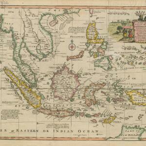
A new and accurate map of the East India Islands: laid down according to the latest discoveries, and agreeable to the most approved maps & charts

event1750

location_onBrunei, Cambodia, East Timor, Indonesia, Laos, Malaysia, Myanmar, Vietnam, Thailand, Southeast Asia, Singapore, Philippines

This mid-18th century map of Southeast Asia includes written notes on goods produced and traded, geographical features, and wild animals found in each part of the region. The cartouche features a drawing of Asia with people, fields and palm trees.

A new and accurate map of the East India Islands: laid down according to the latest discoveries, and agreeable to the most approved maps & charts

event1750

location_onBrunei, Cambodia, East Timor, Indonesia, Laos, Malaysia, Myanmar, Philippines, Singapore, Southeast Asia, Thailand, Vietnam

This mid-18th century map of Southeast Asia includes written notes on goods produced and traded, geographical features, and wild animals found in each part of the region.

A new and accurate map of the East India Islands: laid down according to the latest discoveries, and agreeable to the most approved maps & charts

eventc.1744-1747

location_onBrunei, Cambodia, East Timor, Indonesia, Laos, Malaysia, Myanmar, Philippines, Singapore, Southeast Asia, Thailand, Vietnam

This mid-18th century map of Southeast Asia includes written notes on goods produced and traded, geographical features, and wild animals found in each part of the region.

A map of the East-Indies and the adjacent countries: with the settlements, factories and territories, explaning what belongs to England, Spain, France, Holland, Denmark, Portugal &c.

eventc.1720

location_onBrunei, Cambodia, East Timor, Indonesia, Laos, Malaysia, Myanmar, Philippines, Singapore, Southeast Asia, Thailand, Vietnam

This map showcases the colonial territories of Southeast Asia in the 18th century, with text detailing trading information and the products of each region. There are five inset maps featuring plans of specific trading ports.

close

  • Filter from 1704 to 1899

Current results range from 1704 to 1899