
Search Results


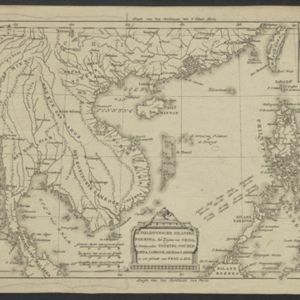


A map of the East-Indies and the adjacent countries: with the settlements, factories and territories, explaning what belongs to England, Spain, France, Holland, Denmark, Portugal &c.
c.1720
Brunei, Cambodia, East Timor, Indonesia, Laos, Malaysia, Myanmar, Philippines, Singapore, Southeast Asia, Thailand, Vietnam

A map of the East-Indies and the adjacent countries: with the settlements, factories and territories, explaning what belongs to England, Spain, France, Holland, Denmark, Portugal &c.
1720
Brunei, Cambodia, East Timor, Indonesia, Laos, Malaysia, Myanmar, Philippines, Vietnam, Thailand, Southeast Asia, Singapore
- [remove]Cambodia32
- Malaysia32
- [remove]Philippines32
- Thailand32
- Vietnam32
- Brunei31
- East Timor31
- Indonesia31
- Singapore31
- Southeast Asia31
- Laos28
- Myanmar28
- more Simple Location »
- [remove]Cartouche32
- [remove]Inset Map32
- Illustration26
- Coat of Arms6
- Legend1


