Search

Search Results

Malay Archipelago, or East India Islands

event1851

location_onBrunei, Cambodia, East Timor, Indonesia, Laos, Malaysia, Myanmar, Papua New Guinea, Philippines, Singapore, Southeast Asia, Thailand, Vietnam

This mid-19th century map of Southeast Asia is illustrated with drawings of indigenous people from New Guinea, a ‘bee bear’ (probably a sun bear), a sailboat in front of Victoria Mount in New Guinea, and a village and palm trees in Sarawak, Borneo.

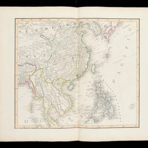
Asia. Plates 42-45 in Lizars' Edinburgh Geographical General Atlas

eventc.1844-1846

location_onBrunei, Cambodia, Indonesia, Laos, Malaysia, Myanmar, Philippines, Thailand, Vietnam

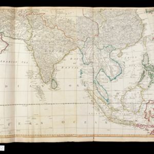
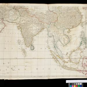
Southeast Asia is featured on the last of the four sheets of this map of Asia. The South China Sea is particularly detailed, with islands, rocks, shoals and reefs named, sometimes dated, and even marked with the name of the ship that mapped them.

The continent and islands of Asia: with all the latest discoveries

event1839

location_onBrunei, Cambodia, East Timor, Indonesia, Laos, Malaysia, Myanmar, Papua New Guinea, Singapore, Philippines, Southeast Asia, Thailand, Vietnam

On this map of Asia, the South China Sea is labelled ‘Malayan Sea’. Small islands, shoals and reefs are shown. A label in Cochin China (Vietnam) reads ‘mountains inhabited by the uncivilized people called Kemoys’.

The continent and islands of Asia: with all the latest discoveries

event1809

location_onVietnam, Myanmar, Papua New Guinea, Philippines, Singapore, Southeast Asia, Thailand, Malaysia, Laos, Indonesia, East Timor, Cambodia, Brunei

Southeast Asia is on the last sheet of this map of Asia. The South China Sea is labelled ‘Malayan Sea’. Small islands, shoals and reefs are shown. A label in Cochin China (Vietnam) reads ‘mountains inhabited by the uncivilized people called Kemoys’.

Asia and its islands according to D'Anville

event1799

location_onBrunei, Cambodia, East Timor, Indonesia, Laos, Malaysia, Myanmar, Papua New Guinea, Philippines, Singapore, Southeast Asia, Thailand, Vietnam

This late 18th century map features a number of labels describing the local populations, including the Kemoys ('Savage People') of the mountains of Cokin China (Vietnam), the Biayos of Borneo, and the 'Wild People' of the mountains of Pegu (Myanmar).

Asia: according to the Sieur D'Anville, divided into its Empires, Kingdoms & States

event1780

location_onBrunei, Cambodia, East Timor, Indonesia, Laos, Malaysia, Myanmar, Papua New Guinea, Philippines, Singapore, Southeast Asia, Thailand, Vietnam

The cartouche on this map of Asia features an Asian man smoking a long pipe, surrounded by packages, vases, a bow and arrow, a censer (incense burner) and a camel carrying a large load. The second sheet of the map features Southeast Asia.

Asia: according to the Sieur D'Anville, divided into its Empires, Kingdoms & States

event1772

location_onBrunei, Cambodia, East Timor, Indonesia, Laos, Malaysia, Myanmar, Papua New Guinea, Philippines, Singapore, Southeast Asia, Thailand, Vietnam

The cartouche on this map of Asia features an Asian man smoking a long pipe, surrounded by packages, vases, a bow and arrow, a censer (incense burner) and a camel carrying a large load. The second sheet of the map features Southeast Asia.

A new and accurate map of the Empire of the Great Mogul, together with India on both sides of the Ganges, and the adjacent countries

eventc.1740

location_onCambodia, Indonesia, Laos, Malaysia, Myanmar, Singapore, Thailand, Vietnam

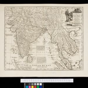
Notes on this map describe European colonial territories and trade with Asia, though this is concentrated around India, and mostly has not yet reached further east to ‘India extra Gangem [India beyond the Ganges]’ as Southeast Asia is labelled.

Asia: corrected from the observations communicated to the Royal Society at London and the Royal Academy at Paris

event1725

location_onBrunei, Cambodia, East Timor, Indonesia, Laos, Malaysia, Myanmar, Philippines, Singapore, Southeast Asia, Thailand, Vietnam

An early 18th century map of Asia by the English cartographer John Senex, featuring labels noting details of the inhabitants of some areas e.g. on Borneo: ‘The Middle of this Isle is Inhabited by a People call’d Beaujous Idolaters’.

A map of the East-Indies and the adjacent countries: with the settlements, factories and territories, explaning what belongs to England, Spain, France, Holland, Denmark, Portugal &c.

event1720

location_onBrunei, Cambodia, East Timor, Indonesia, Laos, Malaysia, Myanmar, Philippines, Vietnam, Thailand, Southeast Asia, Singapore

This map showcases the colonial territories of Southeast Asia in the 18th century, with text detailing trading information and the products of each region. There are five inset maps featuring plans of specific trading ports.

Asia corrected from the observation communicated to the Royal Society at London and the Royal Academy at Paris

eventc.1714

location_onBrunei, Cambodia, East Timor, Indonesia, Laos, Malaysia, Myanmar, Philippines, Singapore, Southeast Asia, Thailand, Vietnam

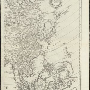
This early 18th century map of Asia features a drawing of a woman burning offerings on an altar, while two children carry cornucopias, and a camel looks on. The Roman god Mercury descends from the sky in the background wearing his winged helmet.

close