
Search Results

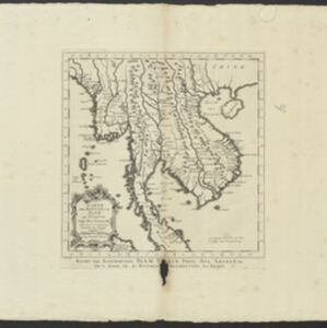
Carte des Royaumes de Siam, de Tunquin, Pegu, Ava, Aracan &c.
c.1755
Cambodia, Laos, Malaysia, Myanmar, Thailand, Vietnam
The kingdoms of mid-18th century mainland Southeast Asia are shown on this map: Ava and Pegu (Myanmar), Siam (Thailand), Tonquin and Cochinchine (Vietnam), Camboie (Cambodia) and Laos. The text is in French, with the title also in Dutch at the base.
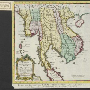


