Search

Search Results

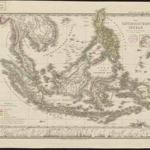
Die Ostindischen Inseln

event1846

location_onBrunei, Cambodia, East Timor, Indonesia, Laos, Malaysia, Myanmar, Philippines, Singapore, Southeast Asia, Thailand, Vietnam

Map of Southeast Asia highlighting the colonial possessions of the Netherlands (Dutch East Indies), Spain (Philippines), Britain (Straits Settlements, Burma, part of Borneo) and Portugal (East Timor). From the German atlas ‘Stielers Handatlas’.
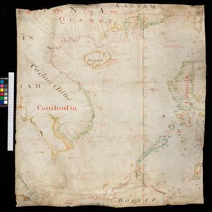
[Portolan chart of the South China Sea]

event1701

location_onBrunei, Cambodia, Indonesia, Laos, Malaysia, Philippines, Thailand, Vietnam

Hand-drawn portolan (nautical) chart, featuring a rhumbline network (the web of interconnected lines), bathymetry (sea depth), shoals and reefs, names of coastal settlements, and an elevation (side view) of a mountain at the north tip of Borneo.

close

  • Filter from 1701 to 1857

Current results range from 1701 to 1857