Carte de l'ile de Java: partie occidentale, partie orientale, dressée tout nouvellement sur les mémoires les plus exacts
event1720
location_onIndonesia
Chart of the North Coast of Java from Samarang to Batavia
event1740
location_onIndonesia
Royaume de Siam, avec les Royaumes qui luy sont Tributaires, et les Isles de Sumatra, Andemaon etc.
event1742
location_onBrunei, Cambodia, Indonesia, Laos, Malaysia, Myanmar, Singapore, Thailand, Vietnam
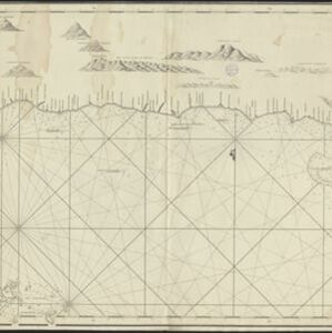
Carte d'une partie de la Cote de Cochinchine: depuis l'Isle Cham-Collao jusqu'à la Riv. du Roi
event1775
location_onVietnam
Plan de Salangor et de La Cote de Malaye: depuis la Pointe de Caran jusqu'au Mont Parcelar
event1775
location_onMalaysia
Plan de Salangor et de La Cote de Malaye: depuis la Pointe de Caran jusqu'au Mont Parcelar
event1775
location_onMalaysia
A general chart of the Atlantic and Indian oceans, with the situation & plan of Pulo Peenang or Price of Wales's Island / Plan of the Strait within Poolo Pinang
event1788
location_onMalaysia, East Timor, Indonesia, Papua New Guinea, Singapore
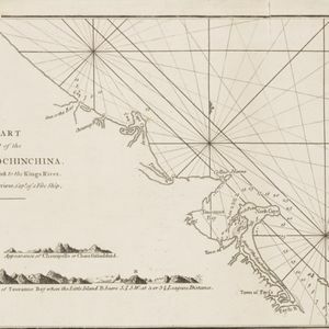
A chart of a part of the coast of Cochinchina: from Cham-Collao Island to the King's River
event1794
location_onVietnam
The coast of India and China from the point and river of Camboja to Canton: comprehending the coasts of Tsiompa and Cochinchina, with the coast of Tonkin and the coast of Koan-Ton, with the isle of Hai-nan
event1794
location_onCambodia, Vietnam
A new chart of the eastern straits to China drawn from the best authorities
event1800
location_onIndonesia
Map of the River of Don-nai from Cape St. James to the city of Saigon