location_onBrunei, Cambodia, Indonesia, Laos, Malaysia, Philippines, Thailand, Vietnam
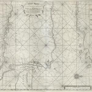
A large draught of the east end of Java and Madura shewing the Streights of Bally
event1711
location_onIndonesia
Chart of the North Coast of Java from Samarang to Batavia
event1740
location_onIndonesia
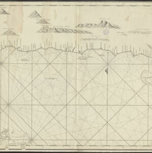
A chart of the seas between the Straits of Banca and Po. Timon: with the eastern part of the Straits of Malacca
event1767
location_onIndonesia, Malaysia
Bintang
eventc.1775-1799
location_onIndonesia, Malaysia
A general chart of the Atlantic and Indian oceans, with the situation & plan of Pulo Peenang or Price of Wales's Island / Plan of the Strait within Poolo Pinang
event1788
location_onMalaysia, East Timor, Indonesia, Papua New Guinea, Singapore
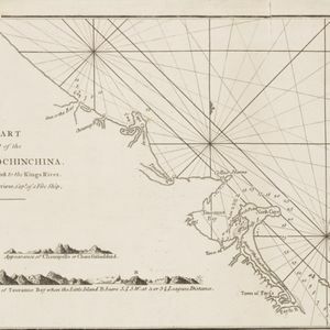
A chart of a part of the coast of Cochinchina: from Cham-Collao Island to the King's River
event1794
location_onVietnam
A new chart containing the southwest part of the China Sea comprised between the Malaya Peninsula, Straits of Singapore &c. the Straits of Banca, Gaspar and Billiton and the Isle of Borneo
event1794
location_onIndonesia
A new chart of the straits of Sunda: From the manuscript of the Dutch East India Company
event1794
location_onIndonesia
Plan of Pulo Condor
event1794
location_onVietnam
Sketch of the Straits of Gaspar
event1794
location_on-
The coast of India and China from the point and river of Camboja to Canton: comprehending the coasts of Tsiompa and Cochinchina, with the coast of Tonkin and the coast of Koan-Ton, with the isle of Hai-nan