Search Results

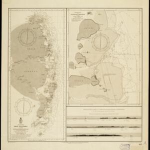
Oostkust: Aroe-Eilanden / Ankerplaats voor Watoelei en Koemoel
1896
Indonesia
Map of the east coast of the Aru Islands (Maluku Islands), with bathymetry (sea depth), tides and currents, shoals and other obstructions. An inset map shows the anchorage at islands off the coast, along with elevation views of the islands.
- Anambas Eilanden1
- Anambas Islands1
- Aroe-Eilanden1
- Aru Islands1
- Bajau Island1
- Chineesche Zee1
- Dutch East Indies1
- Jemaja Island1
- Kepulauan Aru1
- Koemoel1
- Kumul Island1
- Maluku Islands1
- more Detailed Location »
- Bathymetry2
- [remove]Current Data2
- Tide Data2
- Maritime Route1
- Coat of Arms2
- [remove]Elevation2
- Legend2
- Inset Map1
- [remove]The Hague2
- Amsterdam1
- Haarlem1