Search

Search Results

't Groodt Timoor

eventc.1700-1899

location_onEast Timor, Indonesia

Map of Timor with Dutch and Portuguese flags marking military forts. Details are represented pictorially e.g. villages by small houses, forests by trees. There are extensive handwritten annotations, with some text translated from Dutch to French.

Bintang

eventc.1775-1799

location_onIndonesia, Malaysia

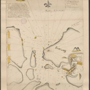
Hand-drawn map of islands in the Riau Archipelago, with bathymetry (sea depth) marked. It features side views of hills (‘elevations’) to use as landmarks, including ‘Jehore hill’, probably in Johor at the southern tip of the Malay Peninsula.

Plan de L'Isle Condor

event1775

location_onVietnam

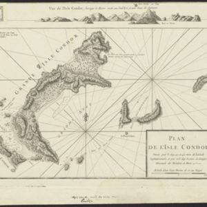
There is a port at the south of this map of the Côn Đảo archipelago (Vietnam), and notes giving details such as a suitable location to careen ships (turning a ship on its side for cleaning or repair). A ruined English fort is also marked.

Laphao

event1780

location_onEast Timor, Indonesia

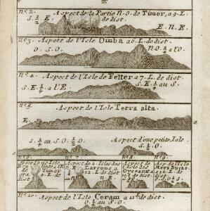
A page from Abbé Prévost’s ‘Histoire Générale des Voyages’. The top map shows the Bay of Laphao on Timor, while the other drawings are side views (or ‘elevations’) of mountains on the region’s islands to use as landmarks when navigating.

Kaart van een Gedeelte der Kust van Cochin-China, met de baai en haven van Turon, en het eiland Kal Lao

event1793

location_onVietnam

A map to aid navigation around the Bay of Turon (location of modern city of Da Nang, Vietnam). Bathymetry (sea depth) is marked, as is the route of the Dutch ship ‘Jackaij’ on her departure from the bay. An elevation view of the land is shown below.

Plan of Pulo Condor

event1794

location_onVietnam

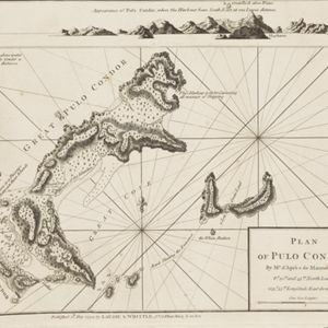
There is a port at the south of this map of the Côn Đảo archipelago (Vietnam), and notes giving details such as a suitable location to careen ships (turning a ship on its side for cleaning or repair). A ruined English fort is also marked.

Map of the River of Don-nai from Cape St. James to the city of Saigon

event1820

location_onVietnam

A map to aid in the navigation of the rivers leading to Saigon (Ho Chi Minh City, Vietnam). Details include bathymetry (water depth), currents, and a side view (or ‘elevation’) of hills to use as a landmark. Tides are described in written remarks.

Algemeene kaart van Nederlandsch Oostindie

eventc.1839-1855

location_onEast Timor, Indonesia, Malaysia, Singapore

This map of the Dutch East Indies is spread over eight sheets, with a hand-drawn cover sheet showing the whole area. There are numerous inset maps of islands, bays, cities etc. Two of the inset maps have a replacement map pasted over them.

Algemeene Kaart van Nederlandsch Oostindie

event1842

location_onEast Timor, Indonesia, Malaysia, Singapore

This detailed map of the Dutch East Indies in the mid-19th century is spread over eight sheets, plus a cover sheet showing the whole area. There are numerous inset maps of islands, bays, cities etc.

Carte de l'île de Java

event1847

location_onIndonesia

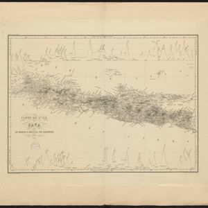
This map uses hachures—short lines/dashes that give a sense of the shape and steepness of terrain—to show Java’s mountains. There are also two side views (elevations) of the mountains showing the heights of various road routes across the island.

close