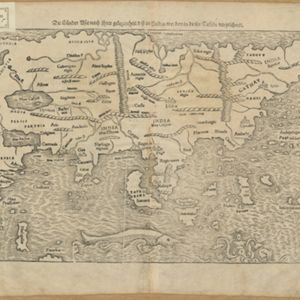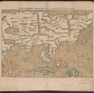
Die Laender Asie nach ihrer Gelegenheit biss in Indiam, werden in dieser Tafeln verzeichnet
1550
Cambodia, Indonesia, Laos, Malaysia, Philippines, Southeast Asia, Thailand, Vietnam, Myanmar, Brunei, East Timor, Singapore
This 1550 map by the German cartographer Sebastian Münster (1488–1552) was based on the work of the 2nd century geographer Ptolemy. There are many inaccuracies, especially in scale and the locations of mountain ranges, but the region is recognisable.