
Search Results
176 Results found

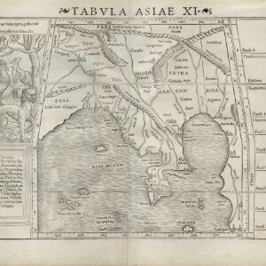
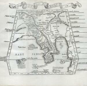
Tabvla Asiae XI
c.1542-1552
Cambodia, Indonesia, Malaysia, Myanmar, Singapore, Thailand, Vietnam, Southeast Asia
Early map by Sebastian Münster, based on the work of 2nd century geographer Ptolemy. The Malay Peninsula—labelled ‘Aurea Chersonesus [Golden Chersonese]’—is recognisable. An illustration shows the local animals: a tiger, cockerels and a white parrot.
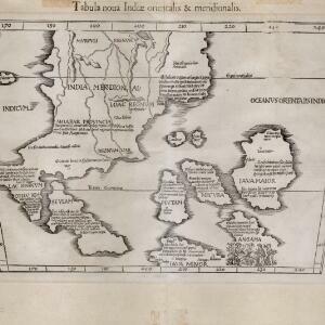
Tabula noua Indiæ orientalis & meridionalis
1541
Malaysia, Indonesia, Southeast Asia
This early map of Asia includes text describing the local people, their religious beliefs, crops, spices etc. On the island labelled Angama there is a drawing of anthropophagi—members of a mythical race of cannibals—chopping up a human body.

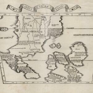
India extrema, XIX nova tabvla
1540
Brunei, Cambodia, East Timor, Indonesia, Laos, Malaysia, Myanmar, Philippines, Singapore, Southeast Asia, Thailand, Vietnam
This 1540 map by the German cartographer Sebastian Münster (1488–1552) was based on the work of the 2nd century geographer Ptolemy. On the reverse, there is Latin text giving details of the area, including crops grown.
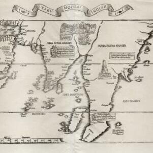
Tabv moder Indiae
1535
Cambodia, Indonesia, Malaysia, Myanmar, Thailand, Vietnam
Early map of Asia, with the islands of Taprobana (Sumatra) to the west of the Malay Peninsula, and Timonia (Tioman) to the east. Text gives details of local economies: sandalwood on Tioman, and silver and silk at Lamai near Mallaqua (Malacca).
Tabvla XI Asiae
1522
Cambodia, Indonesia, Laos, Malaysia, Myanmar, Singapore, Thailand, Vietnam, Southeast Asia
Early map by Lorenz Fries, based on the work of 2nd century geographer Ptolemy. The Malay Peninsula—labelled ‘Aurea Chersone [Golden Chersonese]’—is recognisable. A drawing on the reverse features cannibals with dog’s heads chopping up human bodies.
Vndecima Asiae Tabvla
1511
Cambodia, Laos, Malaysia, Myanmar, Singapore, Thailand, Vietnam
Based on the work of 2nd century geographer Ptolemy, Bernardo Silvani’s woodcut map is innovative in its use of two colours: a black background with important text added in red. The Malay Peninsula is labelled ‘Aurea Chersonesus [Golden Chersonese]’.
- Filter from 1511 to 1840
- Indonesia167
- Malaysia147
- Myanmar141
- Cambodia137
- Thailand137
- Vietnam136
- Singapore135
- Laos133
- Philippines129
- Southeast Asia129
- Brunei127
- East Timor123
- more Simple Location »
- [remove]Illustration176
- Cartouche142
- Inset Map26
- Coat of Arms17
- Elevation7


