Search Results
![](https://historicalmaps.yale-nus.edu.sg/rails/active_storage/representations/eyJfcmFpbHMiOnsibWVzc2FnZSI6IkJBaHBKdz09IiwiZXhwIjpudWxsLCJwdXIiOiJibG9iX2lkIn19--93ba01433ccf1fa0d701904ce109057740666b42/eyJfcmFpbHMiOnsibWVzc2FnZSI6IkJBaDdCam9MY21WemFYcGxTU0lNTkRBd2VETXdNQVk2QmtWVSIsImV4cCI6bnVsbCwicHVyIjoidmFyaWF0aW9uIn19--bc467f5637e8b6d3bfb826116f92b6bfedfbf03a/bodleian-0229.jpeg)
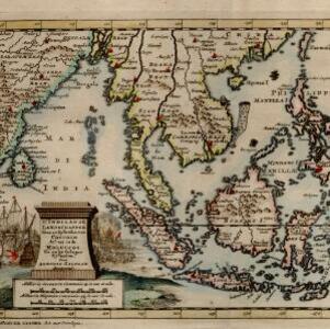
A map of the East-Indies and the adjacent countries: with the settlements, factories and territories, explaning what belongs to England, Spain, France, Holland, Denmark, Portugal &c.
1720
Brunei, Cambodia, East Timor, Indonesia, Laos, Malaysia, Myanmar, Philippines, Vietnam, Thailand, Southeast Asia, Singapore
- Brunei31
- Cambodia31
- East Timor31
- Indonesia31
- Laos31
- Malaysia31
- Myanmar31
- Philippines31
- Southeast Asia31
- Thailand31
- Vietnam31
- Singapore30
- more Simple Location »
- Borneo31
- [remove]Iava31
- [remove]Malacca31
- Sumatra31
- Celebes30
- Java30
- Sulawesi30
- Malay Peninsula28
- Pegu26
- Siam24
- Tonquin17
- East Indies16
- more Detailed Location »
- [remove]Reef31
- Shoal31
- Cartouche31
- [remove]Illustration31
- Coat of Arms6
- Inset Map6
- Wit, Frederik de12
- Goos, Pieter4
- Moll, Herman4
- Allard, Carel2
- Lamb, Francis2
- Speed, John2
- Visscher, Nicolaes2
- Allard, Huych1
- more Map Maker »
- Joannes Lhuilier6
- Philip Overton3
- Thomas Bowles3
- Carel Allard2
- Jean Cóvens et Corneille Mortier2
- Pieter Goos2
- Alexis Hubert Jaillot1
- Basset and Chiswell1
- more Printer/Publisher »