Search Results

Algemeene kaart van Nederlandsch Oostindie
c.1839-1855
East Timor, Indonesia, Malaysia, Singapore
This map of the Dutch East Indies is spread over eight sheets, with a hand-drawn cover sheet showing the whole area. There are numerous inset maps of islands, bays, cities etc. Two of the inset maps have a replacement map pasted over them.

Royaume de Siam, avec les Royaumes qui luy sont Tributaires, et les Isles de Sumatra, Andemaon etc.
1742
Brunei, Cambodia, Indonesia, Laos, Malaysia, Myanmar, Singapore, Thailand, Vietnam
Map marking the routes through maritime Southeast Asia of two delegations: a French delegation from Brest, France to Siam in 1685; and a Siamese delegation from Siam to Brest in 1686. A note next to Aceh records a sea battle against Portugal in 1616.

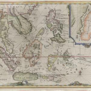
Mar di India
1644
Brunei, Cambodia, East Timor, Indonesia, Laos, Malaysia, Myanmar, Philippines, Singapore, Southeast Asia, Thailand, Vietnam
This mid-17th century map of Southeast Asia is from Isaac Commelin’s book describing the voyages of the Dutch East India Company ‘Begin ende voortgangh…’. There is an inset map of the island of Botton (Buton Island, southeast of Celebes (Sulawesi)).

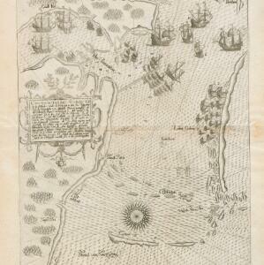
Contrafactur des Scharmutz els der Hollander wider die Portigesen in dem Flus Batusabar
1607
Singapore
Maps can sometimes record a single event: this map depicts an October 1603 battle between the Dutch and Portuguese, as they fought for control of the trade routes through the Singapore Straits. The text panel recounts the story of the battle.


