Search Results
Filter
Insets
Illustration
Remove constraint Insets: Illustration
Sea Features
Shoal
Remove constraint Sea Features: Shoal
Sea Features
Reef
Remove constraint Sea Features: Reef
Political Regions
Regional Border
Remove constraint Political Regions: Regional Border
65 Results found


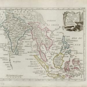
Charte von Asien: nach den bewährtesten astronomischen Beobachtungen, den neuesten Reisen, und den vorzüglichsten Charten, insonderheit aber der Geographie des Hrn I.C. Gatterers gemäss
1793
Brunei, Cambodia, East Timor, Indonesia, Laos, Malaysia, Myanmar, Papua New Guinea, Philippines, Singapore, Southeast Asia, Thailand, Vietnam
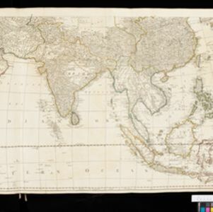