
Search Results
Filter
Insets
Illustration
Remove constraint Insets: Illustration
Political Regions
National Border
Remove constraint Political Regions: National Border
Collections
Beinecke Rare Book and Manuscript Library Yale University
Remove constraint Collections: Beinecke Rare Book and Manuscript Library Yale University
2 Results found
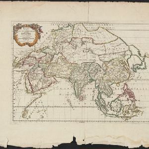
Asia Vetus
1667
Brunei, Cambodia, East Timor, Indonesia, Laos, Malaysia, Myanmar, Philippines, Singapore, Southeast Asia, Thailand, Vietnam
This 17th century map by the French cartographer Nicolas Sanson shows Southeast Asia in the context of the rest of the Asian continent, and even includes parts of Africa and Europe. The decorative cartouche features winged cherubim.


