Search

Search Results

Vaarwaters en ankerplaatsen op de Oostkust van Borneo: Blad I

event1896

location_onIndonesia

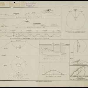
Four navigation maps of waterways on the northeast coast of Borneo, including the Karang Muaras reef. Anchorages, bathymetry (sea depth), shoals and other obstructions are shown, with trees, hills and elevations (side views of hills) as landmarks.

Ankerplaatsen en mondingen van rivieren op de Noord- en Oostkust van Sumatra: Blad II

event1896

location_onIndonesia

Fifteen separate maps of bays and river mouths of Sumatra, including bathymetry (sea depth), anchor points, reefs and shoals, and tide data. There is a drawing of the mouth of the Pidada-rivier.

Oostkust: Aroe-Eilanden / Ankerplaats voor Watoelei en Koemoel

event1896

location_onIndonesia

Map of the east coast of the Aru Islands (Maluku Islands), with bathymetry (sea depth), tides and currents, shoals and other obstructions. An inset map shows the anchorage at islands off the coast, along with elevation views of the islands.

Ankerplaatsen en mondingen van rivieren op de Noord- en Oostkust van Sumatra: Blad I

event1896

location_onIndonesia

Eleven separate maps of bays and river mouths of Sumatra, including two bays on the island on Bras (Breueh Island), and the bay at Kota Radja (Banda Aceh). Bathymetry (sea depth), anchor points, reefs and shoals are marked, along with tide data.

Moluksche archipel: Baai van Amboina

event1895

location_onIndonesia

A map to aid navigation in Ambon Bay, on the island of Ambon in the Maluku Islands: bathymetry (sea depth) and mountains are shown along the coasts, with inset maps of a coal mine pier and Fort Victoria. A second map updates the coal mine pier map.

Kaart van het noorder schiereiland van Halemahera

event1888

location_onIndonesia

Included in a book chapter describing the northern peninsula of Halmahera, this map focuses on the coasts and nearby islands, with the interior left mostly blank. There are seven elevation views of mountains, and two inset maps.

[Grafieken en tekeningen betreffende de uitbarsting van de Krakatau in 1883]

event1883

location_onIndonesia

A series of graphs and drawings about the 1883 eruption of the Krakatoa volcano. Includes elevation views from 1849 and 1880, a globe showing where the eruption was heard, a sketch of the crater of one of the cones, and a cross-section of a volcano.

Bataviasche havenwerken

event1880

location_onIndonesia

A map of the rail, canal and road connections of Batavia (Jakarta, Java) and its port of Tanjung Priok. There is an inset map of the port—harbours, dock, coal sheds, well and water tower—and cross-sections of the inner harbour walls and harbour dam.

[Schetskaarten van versterkingen, loopgraven, stellingen, bentengs e.d. uit de Atjeh oorlog]

event1880

location_onIndonesia

Multiple maps from the Aceh War, spread over 12 sheets. Includes maps of fortifications, trenches, battle formations; building plans, including the Aceh Sultan’s palace; topographic maps; and drawings of a ‘kotta mara’ (fortified raft).

Geognostische kaart van het Oembilien kolenveld in de Padangsche bovenlanden, Sumatra's Westkust

event1874

location_onIndonesia

A geological map, spread over eight sheets, showing the types of rock and minerals found in the Oembilien coalfield, in the Padang Highlands on Sumatra’s west coast. There are also additional geological profiles.

Algemeene kaart van Nederlandsch Oostindie

eventc.1839-1855

location_onEast Timor, Indonesia, Malaysia, Singapore

This map of the Dutch East Indies is spread over eight sheets, with a hand-drawn cover sheet showing the whole area. There are numerous inset maps of islands, bays, cities etc. Two of the inset maps have a replacement map pasted over them.

Karte von der Insel Sumatra

event1837

location_onMalaysia, Indonesia, Singapore

Based on surveys by Sir Stamford Raffles, this German map of Sumatra focuses on the navigation of coasts and straits, with bathymetry (sea depth), anchor points, shoals and reefs marked, including on inset maps of Singapore and the Bangka Strait.

close

  • Filter from 1720 to 1896

Current results range from 1720 to 1896