Search

Search Results

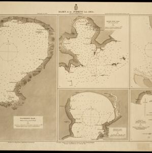
Baaien op de Zuidkust van Java

event1897

location_onIndonesia

Five maps of bays of Java, including bathymetry (sea depth), anchor points, coastal hills, tide data, reefs and shoals. Obstructions in the water are marked ‘gr’ (rough), ‘h’ (hard), ‘k’ (clay), ‘kr’ (coral), ‘m’ (mud), ‘st’ (stones), and ‘z’ (sand).

Atlas van Nederlandsch Oost-Indië

eventc.1897-1904

location_onIndonesia

Very detailed atlas of the entire Dutch East Indies, over 16 map sheets, with a cover and overview map. Includes topographic maps, inset maps of cities and islands, and maps featuring land and sea routes, languages, geology, colonial territory etc.
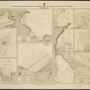
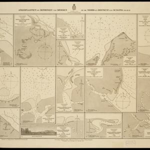
Ankerplaatsen en mondingen van rivieren op de Noord- en Oostkust van Sumatra: Blad II

event1896

location_onIndonesia

Fifteen separate maps of bays and river mouths of Sumatra, including bathymetry (sea depth), anchor points, reefs and shoals, and tide data. There is a drawing of the mouth of the Pidada-rivier.

Ankerplaatsen en mondingen van rivieren op de Noord- en Oostkust van Sumatra: Blad I

event1896

location_onIndonesia

Eleven separate maps of bays and river mouths of Sumatra, including two bays on the island on Bras (Breueh Island), and the bay at Kota Radja (Banda Aceh). Bathymetry (sea depth), anchor points, reefs and shoals are marked, along with tide data.
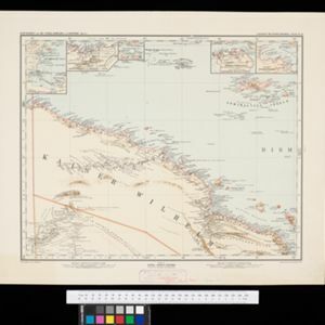
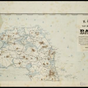
Kaart van de residentie Banka

event1896

location_onIndonesia

Map of the island and residency of Bangka, divided into districts and sub-districts, and featuring mountains, rivers, wetlands, and settlements. The surrounding seas are marked with buoys, depth lines, anchor points, shoals and reefs.

Schutzgebiet der Neu-Guinea-Kompanie

eventc.1892-1893

location_onIndonesia, Papua New Guinea

Very detailed six-sheet map of eastern New Guinea, with numerous inset maps of bays and islands, and other inset maps covering ethnography, explorers of the region, marine routes across the Pacific Ocean, cannibalism, missionaries activity etc.
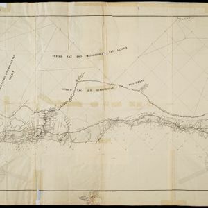
Schetskaart der afdeeling Westkust van Atjeh

event1888

location_onIndonesia

From a Dutch geographical society journal, this map of the west coast of Atjeh (Aceh), Sumatra, shows shoals, reefs, bathymetry (sea depth) and anchor points. On land, there are mountains (with heights), rivers, pepper plantations and rice fields.

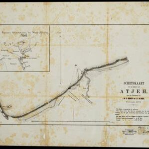
Schetskaart van de reede van Atjeh

event1873

location_onIndonesia

A map of the coast of Atjeh (Aceh), Sumatra, with bathymetry (sea depth), tide information, coconut trees, nipa palm, sugarcane, and two forts. An inset map of the town of Atjeh (Banda Aceh) shows the river, palace, market and villages (‘kampong’).

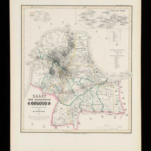
Kaart der Residentie Japara

event1858

location_onIndonesia

Map of the Dutch colonial administrative region (residency) of Japara (Jepara, Java). A cochineal factory—where the dye carmine is made from insects—is shown. (From ‘Algemeene Atlas van Nederlandsche Indie [General Atlas of the Dutch East Indies]’.)

Algemeene Kaart van Nederlandsch Oostindie

event1842

location_onEast Timor, Indonesia, Malaysia, Singapore

This detailed map of the Dutch East Indies in the mid-19th century is spread over eight sheets, plus a cover sheet showing the whole area. There are numerous inset maps of islands, bays, cities etc.

Algemeene kaart van Nederlandsch Oostindie

eventc.1839-1855

location_onEast Timor, Indonesia, Malaysia, Singapore

This map of the Dutch East Indies is spread over eight sheets, with a hand-drawn cover sheet showing the whole area. There are numerous inset maps of islands, bays, cities etc. Two of the inset maps have a replacement map pasted over them.

Reduzirte Karte vom Sunda- oder Borneo-Meere

event1835

location_onIndonesia, Malaysia

A navigation map of the Java Sea and Sunda Islands, with bathymetry (sea depth), maritime routes, shoals and reefs, and elevations (side views of terrestrial landmarks). Inset maps feature the bay at Batavia and the straits between the Sunda Islands.

close