Search

Search Results

Route chart to India and the East

event1895

location_onBrunei, Cambodia, East Timor, Indonesia, Laos, Malaysia, Myanmar, Philippines, Singapore, Southeast Asia, Thailand, Vietnam

Map of Asia featuring steamship routes—including around Southeast Asia—connecting ports such as Penang, Singapore, Batavia (Jakarta), Saigon, Bangkok, Rangun (Yangon), Manila, Macassar (Makassar) etc. There is also an inset map of Singapore.

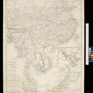
A Map of South Eastern Asia from Peking to Singapore... with an enlarged plan of the environs of Hanoi, on the Red River

event1883

location_onBrunei, Cambodia, Indonesia, Laos, Malaysia, Myanmar, Singapore, Thailand, Vietnam

Map of East Asia, with British colonial possessions—Burma, Straits Settlements, Labuan and British North Borneo—highlighted with red borders. There is also an inset map of the Red River (Hong River) running through Hanoi, Vietnam.

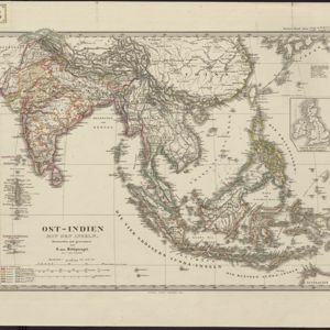
Ost-Indien mit den Inseln

event1857

location_onCambodia, Brunei, East Timor, Indonesia, Laos, Malaysia, Myanmar, Philippines, Singapore, Southeast Asia, Thailand, Vietnam

On this map of India and Southeast Asia, borders are outlined and cities underlined in different colours to show the colonial territories of the European powers. Independent states such as Birma, Siam and Annam are also marked.

S.E. Peninsula and Malaysia

event1849

location_onBrunei, Cambodia, East Timor, Indonesia, Laos, Malaysia, Myanmar, Papua New Guinea, Philippines, Singapore, Southeast Asia, Thailand, Vietnam

The colonial possessions of Britain, the Netherlands, Spain, Portugal and Denmark are shown on this mid-19th century map of Southeast Asia. There are inset maps of Penang Island and Singapore, and text describing the region’s colonial history.

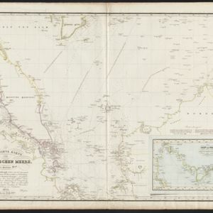
Reduzirte Karte vom Chinesischen Meere: 1stes oder Südliches Blatt

event1835

location_onBrunei, Cambodia, Indonesia, Malaysia, Singapore, Thailand

Navigation map of the southern South China Sea, with bathymetry (sea depth), islands, shoals and reefs marked. There are four maritime routes to China marked, with notes on what months or monsoon season to use them. Inset map of Gulf of Thailand.

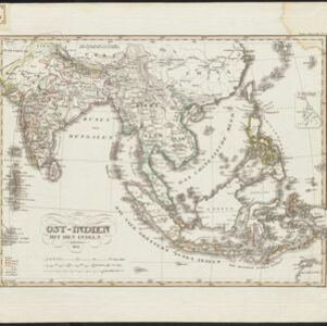
Ost-Indien mit den Inseln

event1831

location_onBrunei, Cambodia, East Timor, Indonesia, Laos, Malaysia, Myanmar, Philippines, Singapore, Southeast Asia, Thailand, Vietnam

On this map of India and Southeast Asia, borders are outlined and cities underlined in different colours to show the colonial territories of the European powers: British, Dutch, Spanish, Portuguese, French and Danish.

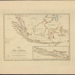
Carte de l'ile de Java et des autres possessions orientales du Royaume des Pays-Bas

event1830

location_onIndonesia, Malaysia, Philippines, East Timor, Singapore

A French map of the Asian colonial possessions of the Netherlands (Dutch East Indies), with an inset map of the island of Java. Colonies of Britain (Malay Peninsula), Spain (the Philippines) and Portugal (parts of Floris and Timor) are also marked.

A map of the East-Indies and the adjacent countries: with the settlements, factories and territories, explaning what belongs to England, Spain, France, Holland, Denmark, Portugal &c.

event1720

location_onBrunei, Cambodia, East Timor, Indonesia, Laos, Malaysia, Myanmar, Philippines, Vietnam, Thailand, Southeast Asia, Singapore

This map showcases the colonial territories of Southeast Asia in the 18th century, with text detailing trading information and the products of each region. There are five inset maps featuring plans of specific trading ports.

close