Search

Search Results

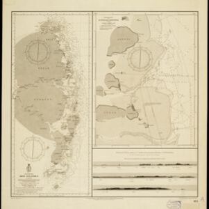
Oostkust: Aroe-Eilanden / Ankerplaats voor Watoelei en Koemoel

event1896

location_onIndonesia

Map of the east coast of the Aru Islands (Maluku Islands), with bathymetry (sea depth), tides and currents, shoals and other obstructions. An inset map shows the anchorage at islands off the coast, along with elevation views of the islands.

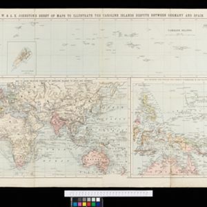
W. & A.K. Johnston's sheet of maps to illustrate the Caroline islands dispute between Germany and Spain

event1885

location_onSoutheast Asia, Papua New Guinea, Indonesia, Philippines, Malaysia, East Timor

Three maps of the Caroline Islands. One shows colonised areas in Southeast Asia: Dutch East Indies; British North Borneo, British New Guinea; German New Guinea; Philippines (Spain); Portuguese Timor. The route of the Challenger expedition is marked.

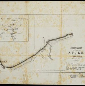
Schetskaart van de reede van Atjeh

event1873

location_onIndonesia

A map of the coast of Atjeh (Aceh), Sumatra, with bathymetry (sea depth), tide information, coconut trees, nipa palm, sugarcane, and two forts. An inset map of the town of Atjeh (Banda Aceh) shows the river, palace, market and villages (‘kampong’).

close

  • Filter from 1873 to 1896

Current results range from 1873 to 1896