Search Results
Filter
Insets
Inset Map
Remove constraint Insets: Inset Map
Detailed Location
Western New Guinea
Remove constraint Detailed Location: Western New Guinea
60 Results found
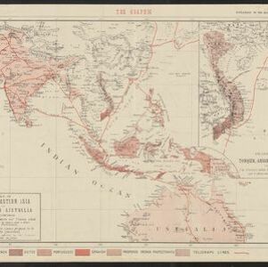
Map of South-Eastern Asia and Northern Australia: showing the districts in Annam and Tonquin which France proposes to annex and to place under a Protectorate, the portion of New Guinea proposed to be acquired by Queensland, and the districts affected by the volcanic eruptions in Java
1883
Southeast Asia, Singapore, Thailand, East Timor, Vietnam, Brunei, Cambodia, Indonesia, Laos, Malaysia, Myanmar, Papua New Guinea, Philippines
- Indonesia60
- East Timor50
- Malaysia49
- Singapore49
- Brunei47
- Philippines44
- Thailand40
- Vietnam37
- Cambodia36
- Laos36
- Myanmar36
- Southeast Asia36
- more Simple Location »
- [remove]Western New Guinea60
- Borneo51
- Sulawesi51
- Sumatra51
- Java49
- Celebes48
- Malay Peninsula46
- Maluku Islands31
- Siam28
- South China Sea25
- New Guinea21
- Malacca17
- more Detailed Location »
- Military Fort12
- Kampong/Village8
- Cemetery/Columbarium7
- Church7
- Hospital7
- Residential Area7
- Public Space4
- Military Barracks3
- Missionary Building3
- Communal Land/Property2
- Court of Law2
- Jail/Prison2
- Palace2
- Post Office2
- more Settlement Features »
- [remove]Inset Map60
- Illustration22
- Legend19
- Cartouche13
- Coat of Arms11
- Elevation3
- Berghaus, Heinrich Karl Wilhelm5
- Arrowsmith, John4
- Johnston, Keith (A.K.)4
- Johnston, William4
- Moll, Herman4
- Allard, Carel2
- Alt, Wilhelm2
- Burgess, Daniel2
- more Map Maker »
- Justus Perthes5
- Adolf Stieler4
- Surveyor General's Office, Brisbane4
- William Blackwood & Sons4
- Intelligence Division, War Office3
- John Arrowsmith3
- Philip Overton3
- Thomas Bowles3
- more Printer/Publisher »
- London14
- Amsterdam8
- Leiden6
- Edinburgh5
- Gotha5
- Batavia3
- Brisbane3
- The Hague3
- more Place of Publication »