Search

Search Results

Map of the Kingdom of Siam and its dependencies

eventc.1900

location_onMyanmar, Malaysia, Singapore, Thailand, Laos, Cambodia, Vietnam

The border of the Kingdom of Siam (Thailand) and its internal administrative districts are highlighted in yellow. Inset maps show the cities of Bangkok, Chiengmai (Chiang Mai) and Luang Pra Bang (Luang Prabang) in more detail.

A map of British North Borneo

event1899

location_onMalaysia, Brunei, Indonesia

The colonial territories of British North Borneo are shown in pink on this late 19th century map, with Brunei and Sarawak in green, and Dutch colonial territory in yellow. Sea routes around the British Empire are depicted on an inset map.

Special Map Illustrating the Spanish-American War

event1898

location_onPhilippines

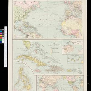
Six maps of locations from the Spanish-American War (1898), including one of the Philippines featuring mountains, rivers, islands and settlements. There is also a world map featuring maritime routes, including around Southeast Asia.

A map of British North Borneo

event1894

location_onMalaysia, Brunei, Indonesia

The colonial territories of British North Borneo are shown in pink on this late 19th century map, with Brunei and Sarawak in green, and Dutch colonial territory in yellow. Sea routes around the British Empire are depicted on an inset map.

Trade Routes in the Far East

event1894

location_onBrunei, Cambodia, Indonesia, Laos, Malaysia, Myanmar, Philippines, Singapore, Thailand, Vietnam

Map of stream ship trade routes around Southeast Asia. Rivers, railways, submarine telegraph cables, lighthouses (fixed, revolving and flashing), graving docks and coaling stations are marked. An inset map shows a railway route from Britain to Asia.

Plan of Singapore town

event1893

location_onSingapore

Large-scale plan of Singapore city, spread over eight sheets. Includes the central civic/business area around the Singapore River, Tanjong Pagar dock, and residential areas. The city is surrounded by suburbs, cemeteries, mangroves, vegetable gardens.

Map to illustrate the Siamese question: showing the present limits of French claims, and the additional territory now demanded

event1893

location_onCambodia, Laos, Malaysia, Myanmar, Thailand, Vietnam

Map highlighting areas of eastern Siam (Thailand) claimed by France. Notes describe Siam’s geography, government, population, military and trade (rice, teak, pepper, bullocks, fish, hides, tin, cardamom, tin), including trading partners by tonnage.

W. & A.K. Johnston's sheet of maps to illustrate the Caroline islands dispute between Germany and Spain

event1885

location_onSoutheast Asia, Papua New Guinea, Indonesia, Philippines, Malaysia, East Timor

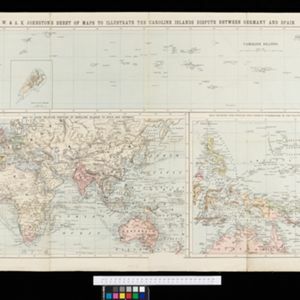
Three maps of the Caroline Islands. One shows colonised areas in Southeast Asia: Dutch East Indies; British North Borneo, British New Guinea; German New Guinea; Philippines (Spain); Portuguese Timor. The route of the Challenger expedition is marked.

A Map of South Eastern Asia from Peking to Singapore... with an enlarged plan of the environs of Hanoi, on the Red River

event1883

location_onBrunei, Cambodia, Indonesia, Laos, Malaysia, Myanmar, Singapore, Thailand, Vietnam

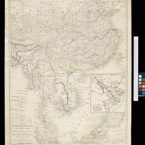
Map of East Asia, with British colonial possessions—Burma, Straits Settlements, Labuan and British North Borneo—highlighted with red borders. There is also an inset map of the Red River (Hong River) running through Hanoi, Vietnam.

Asiatic archipelago

event1876

location_onVietnam, Myanmar, Papua New Guinea, Philippines, Singapore, Southeast Asia, Thailand, Malaysia, Laos, Indonesia, East Timor, Cambodia, Brunei

This late 19th century map of Southeast Asia shows the best maritime routes around the region, according to the time of year. There are also inset maps highlighting the rivers and southern islands of Singapore, and the sea depth around Labuan Island.

Chart of the China Sea

event1864

location_onPapua New Guinea, Indonesia, Malaysia, Cambodia, East Timor, Philippines, Singapore, Thailand, Vietnam

To aid navigation, this map shows small islands, shoals and reefs, maritime routes for use during monsoons or at particular times of the year, bathymetry (sea depth), tide information, shipwrecks, compass roses and landmark mountains at the coasts.

Borneo

event1851

location_onMalaysia, Southeast Asia, Philippines, East Timor, Vietnam, Indonesia, Brunei

Map of Borneo—with insets of Southeast Asia, Sarawak and Labuan—featuring temperature data, volcanoes, English colonial territory, products of Borneo, geology (rock types), bathymetry (sea depth) and elevations (side views of mountains with heights).

close

  • Filter from 1720 to 1900

Current results range from 1720 to 1900