
Search Results


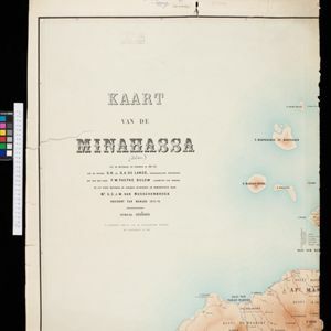
Atlas van Nederlandsch Oost-Indië
c.1897-1904
Indonesia
Very detailed atlas of the entire Dutch East Indies, over 16 map sheets, with a cover and overview map. Includes topographic maps, inset maps of cities and islands, and maps featuring land and sea routes, languages, geology, colonial territory etc.
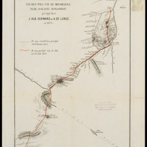
Schetskaart van den weg uit de Minahassa naar Bolaang Mongondou, gevolgd door J.Alb. Schwarz en A. de Lange, in 1875
1876
Indonesia
A map of a route taken by the Dutch Christian missionary Johannes Albert Traugott Schwarz. Over four days, accompanied by Anton de Lange, he walked from Popo (Poopo) south through the Minahasa Peninsula. The map also shows an earlier aborted route.
- Filter from 1876 to 1898
- Celebes4
- [remove]Minahasa Peninsula4
- [remove]Sulawesi4
- Dutch East Indies3
- Minahassa3
- Ambon1
- Banda Aceh1
- Banda Eilanden1
- Banda Islands1
- Bandjarmasin1
- Bangka1
- Banjarmasin1
- more Detailed Location »


