Search

Search Results

Indo-Chine: carte de la mission Pavie

event1899

location_onCambodia, Laos, Myanmar, Thailand, Vietnam

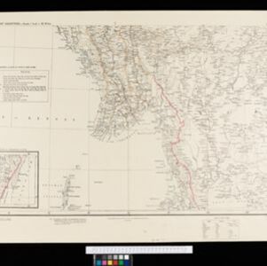
Spread over four sheets, this topographical map was based on the explorations of the French civil servant Auguste Pavie. Lasting 16 years (1879–1895), his ‘Missions Pavie’ explored all of mainland Southeast Asia.

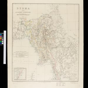
Burma and adjacent countries: With additions and corrections to boundaries and railways up to December, 1898

event1898

location_onMyanmar, Thailand

The regional and national borders of Burma and Siam are hand-coloured on this map. Provinces, districts and states within Burma are also highlighted, and itemised in a separate list.

India

event1898

location_onIndonesia, Malaysia, Myanmar, Thailand

British Burma is coloured pink on this six-sheet map of India. Mountains are represented by hachures—short lines/dashes that give a sense of the shape and steepness of terrain—and settlements, railways, roads, rivers and lighthouses are marked.

Route chart to India and the East

event1895

location_onBrunei, Cambodia, East Timor, Indonesia, Laos, Malaysia, Myanmar, Philippines, Singapore, Southeast Asia, Thailand, Vietnam

Map of Asia featuring steamship routes—including around Southeast Asia—connecting ports such as Penang, Singapore, Batavia (Jakarta), Saigon, Bangkok, Rangun (Yangon), Manila, Macassar (Makassar) etc. There is also an inset map of Singapore.
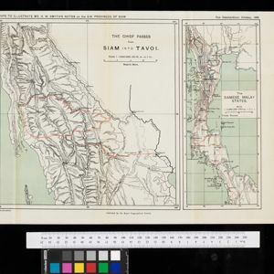
The chief passes from Siam into Tavoi / The Siamese Malay States

event1895

location_onMyanmar, Thailand, Malaysia

Two maps of Siam (Thailand). The larger map shows routes through mountain passes from Siam to the city of Tavoi (Dawei, on the west coast of Myanmar). The smaller map is marked with trade routes around Lower Siam (Southern Thailand).

Burma and adjacent countries

event1892

location_onMyanmar, Thailand

The regional and national borders of Burma and Siam are hand-coloured on this map. Provinces, districts and states within Burma are also highlighted, and itemised in a separate list.

Burma and adjacent countries

event1892

location_onMyanmar, Thailand

The regional and national borders of Burma and Siam are hand-coloured on this map. Provinces, districts and states within Burma are also highlighted, and itemised in a separate list.

[Map of India]

event1887

location_onMyanmar

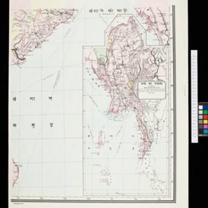
This four-sheet map of India—featuring an inset map of Burma (Myanmar) —was created for use in Indian schools by Devendranath Dhar, a self-taught Calcutta-based mapmaker. He sent it to the Royal Asiatic Society for advice on publication.

Extension of the Electric Telegraph to Canton, Hong Kong, etc. from the Port of Rangoon

event1860

location_onMyanmar, Cambodia, Indonesia, Laos, Malaysia, Singapore, Thailand, Vietnam

Map of a proposed extension of a telegraph system from Rangoon (Yangon, Myanmar) to China. Includes current and projected railways, steam ship routes, and population figures for western China. From the British magazine ‘The Illustrated London News’.

close

  • Filter from 1860 to 1899

Current results range from 1860 to 1899