Search

Search Results

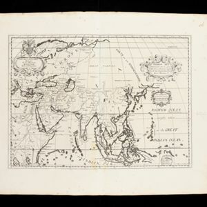
Present Asia: distinguisht into its general divisions or countries together with their capital cities chief rivers mountains &c.

event1701

location_onBrunei, Cambodia, East Timor, Indonesia, Laos, Malaysia, Myanmar, Papua New Guinea, Philippines, Singapore, Southeast Asia, Thailand, Vietnam

This map of Asia is dedicated to Prince William, Duke of Gloucester, and features a drawing of his coat of arms. He had been in line to succeed to the English throne, but died at the age of 11 in 1700, the year before this map was produced.

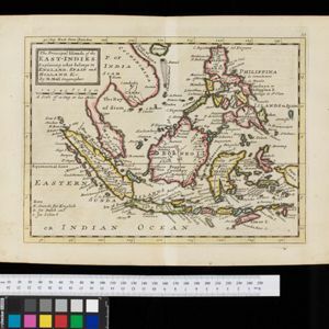
The principal islands of the East-Indies: explaining what belongs to England, Spain and Holland &c.

event1732

location_onBrunei, Cambodia, East Timor, Indonesia, Philippines, Malaysia, Thailand, Vietnam, Singapore, Southeast Asia

The letters ‘E’ or ‘D’ are marked after place names to indicate if they are English or Dutch colonial possessions: e.g. ‘Marleborough Fort E’ on Sumatra or ‘Concordia Fort D’ on Timor. The Philippines are labelled ‘to Spain’.

The principal islands of the East-Indies: explaining what belongs to England, Spain and Holland &c.

eventc.1732

location_onBrunei, Cambodia, East Timor, Indonesia, Philippines, Malaysia, Thailand, Vietnam, Singapore, Southeast Asia

The letters ‘E’ or ‘D’ are marked after place names to indicate if they are English or Dutch colonial possessions: e.g. ‘Marleborough Fort E’ on Sumatra or ‘Concordia Fort D’ on Timor. The Philippines are labelled ‘to Spain’.

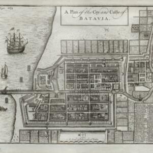
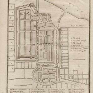
A plan of the city and castle of Batavia

event1746

location_onIndonesia

A mid-18th century plan of Batavia (Jakarta), the main port of the Dutch East India Company's trading network in Southeast Asia. Ships can be seen transporting goods along ‘The Great River’ to the sea, overseen by Batavia Castle at the river’s mouth.

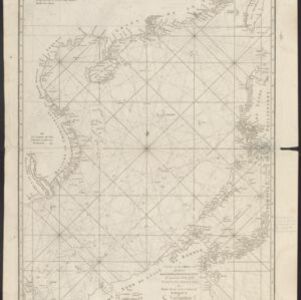
Chart of the China Sea

event1746

location_onBrunei, Cambodia, Indonesia, Malaysia, Philippines, Vietnam

This map features eight expedition routes across the South China Sea from 1752 to 1763. The web of lines is a rhumbline network, and bathymetry (sea depth) is marked. The place names are in French, but with an English title and notes.

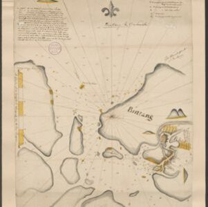
Bintang

eventc.1775-1799

location_onIndonesia, Malaysia

Hand-drawn map of islands in the Riau Archipelago, with bathymetry (sea depth) marked. It features side views of hills (‘elevations’) to use as landmarks, including ‘Jehore hill’, probably in Johor at the southern tip of the Malay Peninsula.

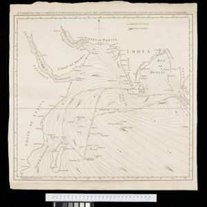
A chart of the currents in the Indian Sea during the southwest monsoon, to the northward of the line / A chart of the currents in the Indian Sea during the northeast monsoon, to the northward of the line

event1794

location_onMalaysia, Indonesia, Myanmar, Thailand

Two maps of the Indian Ocean showing currents (represented by arrows) and winds (represented by letters A to F) during the monsoon seasons. Three routes—one old and two new—from the Isle de France (Mauritius) east to the Strait of Malacca are shown.

Batavia

event1812

location_onIndonesia

A plan of Batavia in the early 19th century, with the castle, church, dock yard, timber yard and hospital highlighted on the map’s legend. Also shown is the canal flowing through the city to the port, where the sea depth (‘soundings’) is indicated.

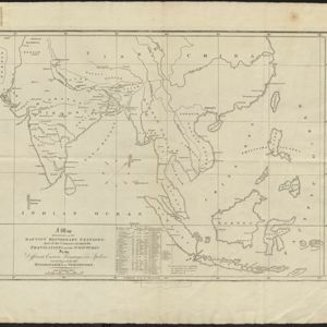
A Map Illustrative of the Baptist Missionary Stations

event1815

location_onBrunei, Cambodia, East Timor, Indonesia, Laos, Malaysia, Myanmar, Philippines, Singapore, Southeast Asia, Thailand, Vietnam

This map marks the locations of Baptist missionary stations in Asia, including at Ava, Rangoon, Java and Amboyna (Ambon) in Southeast Asia. The station at Java also has a school. The map’s legend lists the stations’ dates of foundation.

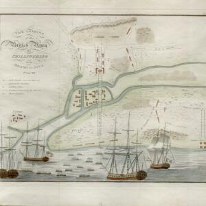
The landing of the British Army at Chillinching on the island of Java 4th Augt. 1811

event1815

location_onIndonesia

A map of the landing of British troops at Chillinching (Cilincing, 12 miles to the east of Batavia), part of the 1811 invasion of Java during the Napoleonic Wars. The frigate Leda is at the river mouth, as the British soldiers row to shore.

close