
Search Results


Plan topographique de l'arrondissment de Longxuyen
1886
Vietnam
Map of the district of Longxuyen (Long Xuyên in the Mekong Delta, Vietnam). The city of Long Xuyên is on the southern bank of the Bassac River (labelled ‘Fleuve Postérieur’ and ‘Fleuve Antérieur’), surrounded by rivers, wetlands, fields and villages.


Itinéraires de Mr A. Pavie dans le Sud-Ouest l'Indo-Chine Orientale (Cambodge et Siam) (1880-1884)
1884
Thailand, Cambodia
The routes taken by the French civil servant and explorer Auguste Pavie are marked on this map of Siam (Thailand) and Cambodge (Cambodia), along with the telegraph line that he subsequently constructed from Pnom Penh (Phnom Penh) to Bangkok.

Kaart der Nederlandsche bezittingen in Oostindien = Possessions hollanaises aux Indes Orientales
1840
Brunei, East Timor, Indonesia, Malaysia, Singapore
Map of Dutch colonial territory in Southeast Asia, including the administrative areas of Java and Madura. Two maritime routes are marked from Batavia to the Maluku Islands: of the brig ‘Douga’ in 1825, and by Baron Godert van der Capellen in 1824.
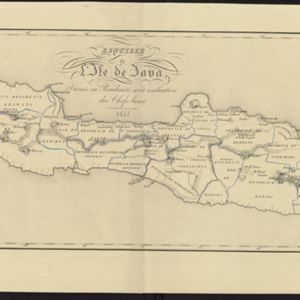
Esquisse de l'ile de Java: divisée en Residences avec indication des chefs-lieux
1833
Indonesia
Map of Java divided into Dutch administrative areas (‘residencies’), and the Empire of Soerakarta and Kingdom of Djokjakarta, which were under indigenous rule (a note records the territories these indigenous areas lost in the Java War (1825–1830)).

Carte de l'ile de Java et des autres possessions orientales du Royaume des Pays-Bas
1830
Indonesia, Malaysia, Philippines, East Timor, Singapore
A French map of the Asian colonial possessions of the Netherlands (Dutch East Indies), with an inset map of the island of Java. Colonies of Britain (Malay Peninsula), Spain (the Philippines) and Portugal (parts of Floris and Timor) are also marked.
- Filter from 1826 to 1899
- [remove]District/Administrative Border13
- Colonial Possessions7
- Regional Border3
- National Border1


