Search Results
Filter
Insets
Legend
Remove constraint Insets: Legend
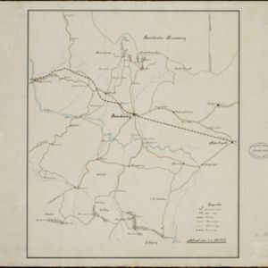
Detailed Location
Bandoeng
Remove constraint Detailed Location: Bandoeng
Settlement Features
Kampong/Village
Remove constraint Settlement Features: Kampong/Village
Transport Hubs
Railway Station
Remove constraint Transport Hubs: Railway Station
Collections
Leiden University Libraries
Remove constraint Collections: Leiden University Libraries
4 Results found


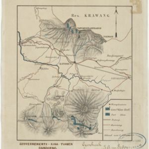
Topographische kaart van de residentie Preanger regentschappen
1894
Indonesia
The residency of Preanger (Parahyangan), West Java, with plantations (coconut, coffee, tea, cinchona (‘kina’), betel, teakwood, bamboo) and crops (rice, sugarcane, alang-alang). Two inset maps: a triangulation map, and a map of land route distances.