Search

Search Results

Stanford's Library Map of Asia

event1899

location_onBrunei, Cambodia, East Timor, Indonesia, Laos, Malaysia, Myanmar, Philippines, Singapore, Southeast Asia, Thailand, Vietnam

Southeast Asia is on sheet four of this map. British colonial territory—British Burma, the Straits Settlements, Sarawak, Brunei, British North Borneo—is highlighted in red, with Dutch, Spanish, French and Portuguese territory also shown.

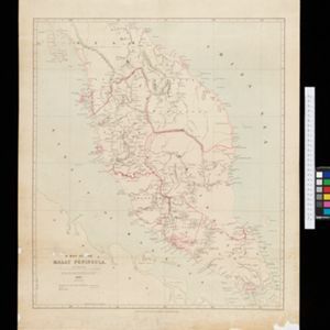
A Map of the Malay Peninsula

event1897

location_onIndonesia, Malaysia, Singapore, Thailand

On this late 19th century map of the Malay Peninsula, the British colonial territories—the Straits Settlements of Singapore, Malacca, Dinding and Penang—are in red, demarcating them from the British protectorate states of the rest of the peninsula.

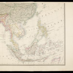
Stanford's Library Map of Asia

event1891

location_onBrunei, Cambodia, East Timor, Indonesia, Laos, Malaysia, Myanmar, Philippines, Singapore, Southeast Asia, Thailand, Vietnam

Southeast Asia is on sheet four of this map. British colonial territory—British Burma, the Straits Settlements, Sarawak, British North Borneo—is highlighted in red, with the Dutch East Indies, Spanish Philippines and Portuguese East Timor also shown.

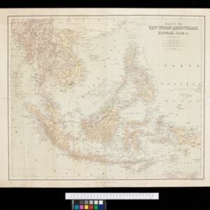
Malay, or East Indian Archipelago, with Burmah, Siam &c.

event1887

location_onBrunei, Cambodia, East Timor, Indonesia, Laos, Malaysia, Myanmar, Philippines, Singapore, Southeast Asia, Thailand, Vietnam

On this map of Southeast Asia, numerous small islands, shoals and reefs are marked and named, especially in the South China Sea and around the Sunda and Maluku islands. Submarine cables to carry telegraph messages around the region are also shown.

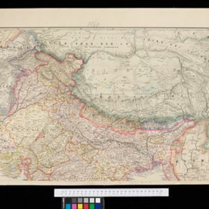
India, Burmah and the adjacent parts of Beluchistan, Afghanistan, Turkestan, the Chinese Empire, and Siam

event1887

location_onMyanmar, Thailand, Malaysia, Indonesia

British Burma is shown on the right of this two-sheet map of India. The green areas had come under British rule after the first and second Anglo-Burmese wars, with Upper Burma (light brown) being incorporated after the Third Anglo-Burmese War (1885).

Stanford's portable map of India shewing its present divisions and the adjacent parts of Beluchistan, Afghanistan, Turkestan, the Chinese Empire, Burmah and Siam

event1869

location_onMyanmar, Indonesia, Thailand

This two-sheet map of India includes Burma (Myanmar) and Siam. British Burma—which came under British colonial rule after the first (1824–1826) and second (1852–1853) Anglo-Burmese wars—is highlighted in red.

Stanford's library map of Asia

event1862

location_onBrunei, Cambodia, East Timor, Indonesia, Laos, Myanmar, Malaysia, Philippines, Singapore, Southeast Asia, Thailand, Vietnam

Map of Asia on four sheets, with Southeast Asia on sheet four. British colonial territory—British Burma, the Straits Settlements, Sarawak—is highlighted in red, with the Dutch East Indies, Spanish Philippines and Portuguese East Timor also shown.

Extension of the Electric Telegraph to Canton, Hong Kong, etc. from the Port of Rangoon

event1860

location_onMyanmar, Cambodia, Indonesia, Laos, Malaysia, Singapore, Thailand, Vietnam

Map of a proposed extension of a telegraph system from Rangoon (Yangon, Myanmar) to China. Includes current and projected railways, steam ship routes, and population figures for western China. From the British magazine ‘The Illustrated London News’.

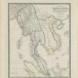
Map of the Burman Empire including also Siam, Cochin-China, Ton-king and Malaya

event1842

location_onVietnam, Myanmar, Malaysia, Indonesia, Thailand, Laos, Cambodia, Brunei, Singapore

Regional borders are colour-coded on this mid-19th century map of mainland Southeast Asia, with British colonial territory in red (including part of the Burman Empire, the Straits Settlements, and Sarawak on Borneo).

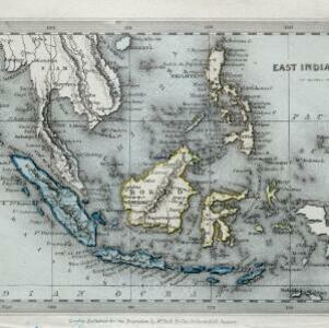
East India Islands

event1840

location_onVietnam, Myanmar, Papua New Guinea, Philippines, Singapore, Southeast Asia, Thailand, Malaysia, Laos, Indonesia, East Timor, Cambodia, Brunei

The colonial possessions of Britain (in red, though faded on this map), the Netherlands (green, but discoloured to blue) and Spain (the Philippines, brown) are shown on this map, with independent areas such as Borneo and the Maluku Islands in yellow.

Eastern islands or Malay archipelago

event1836

location_onBrunei, Cambodia, East Timor, Indonesia, Laos, Malaysia, Myanmar, Philippines, Singapore, Southeast Asia, Vietnam, Thailand

Brief notes printed on this 19th century map of Southeast Asia provide details about each region, including: numbers and ethnicity of the population, local or colonial rulers, crops and products, geography (corals, forests, volcanos, earthquakes).

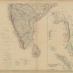
India (south part)

event1824

location_onMyanmar, Malaysia, Singapore, Thailand, Indonesia

The inset map on this map of India features part of mainland Southeast Asia: Pegu and the Tenasserim Provinces (Myanmar), Siam (Thailand), and the Malay Peninsula (Malaysia), with the Straits Settlements—Singapore, Malacca, Penang—highlighted in red.

close

  • Filter from 1732 to 1899

Current results range from 1732 to 1899