Search

Search Results

Principal Dutch colonies in the Indian seas

event1872

location_onBrunei, Indonesia, Malaysia

Two maps of the Dutch East Indies, decorated with drawings of local people and animals. Dutch colonial territory and local sultanates and provinces are highlighted. The heights of Java’s mountains and settlements are displayed in an elevation view.

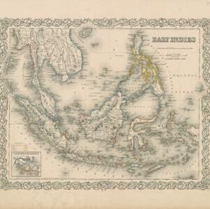
East Indies

event1855

location_onBrunei, Cambodia, East Timor, Indonesia, Laos, Malaysia, Myanmar, Philippines, Singapore, Southeast Asia, Thailand, Vietnam

Coloured borders are used to highlight the colonial territories of the British (red), Dutch (orange), Spanish (red) and Portuguese (blue) on this mid-19th century map of Southeast Asia. An inset map shows the island and strait of Singapore.

S.E. Peninsula and Malaysia

event1849

location_onBrunei, Cambodia, East Timor, Indonesia, Laos, Malaysia, Myanmar, Papua New Guinea, Philippines, Singapore, Southeast Asia, Thailand, Vietnam

The colonial possessions of Britain, the Netherlands, Spain, Portugal and Denmark are shown on this mid-19th century map of Southeast Asia. There are inset maps of Penang Island and Singapore, and text describing the region’s colonial history.

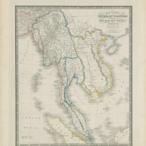
Map of the Burman Empire including also Siam, Cochin-China, Ton-king and Malaya

event1842

location_onVietnam, Myanmar, Malaysia, Indonesia, Thailand, Laos, Cambodia, Brunei, Singapore

Regional borders are colour-coded on this mid-19th century map of mainland Southeast Asia, with British colonial territory in red (including part of the Burman Empire, the Straits Settlements, and Sarawak on Borneo).

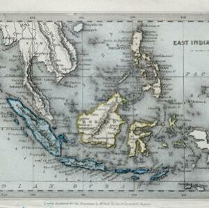
East India Islands

event1840

location_onVietnam, Myanmar, Papua New Guinea, Philippines, Singapore, Southeast Asia, Thailand, Malaysia, Laos, Indonesia, East Timor, Cambodia, Brunei

The colonial possessions of Britain (in red, though faded on this map), the Netherlands (green, but discoloured to blue) and Spain (the Philippines, brown) are shown on this map, with independent areas such as Borneo and the Maluku Islands in yellow.

Eastern islands or Malay archipelago

event1836

location_onBrunei, Cambodia, East Timor, Indonesia, Laos, Malaysia, Myanmar, Philippines, Singapore, Southeast Asia, Vietnam, Thailand

Brief notes printed on this 19th century map of Southeast Asia provide details about each region, including: numbers and ethnicity of the population, local or colonial rulers, crops and products, geography (corals, forests, volcanos, earthquakes).

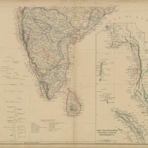
India (south part)

event1824

location_onMyanmar, Malaysia, Singapore, Thailand, Indonesia

The inset map on this map of India features part of mainland Southeast Asia: Pegu and the Tenasserim Provinces (Myanmar), Siam (Thailand), and the Malay Peninsula (Malaysia), with the Straits Settlements—Singapore, Malacca, Penang—highlighted in red.

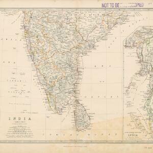
India (southern sheet)

event1824

location_onMyanmar, Malaysia, Indonesia, Singapore, Thailand

The inset map on this map of India features part of mainland Southeast Asia, with the British colonial territories—Straits Settlements, British Burma—highlighted in red, ‘protected states’ in yellow, and ‘independent states’ in green.

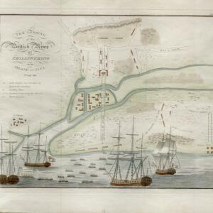
The landing of the British Army at Chillinching on the island of Java 4th Augt. 1811

event1815

location_onIndonesia

A map of the landing of British troops at Chillinching (Cilincing, 12 miles to the east of Batavia), part of the 1811 invasion of Java during the Napoleonic Wars. The frigate Leda is at the river mouth, as the British soldiers row to shore.

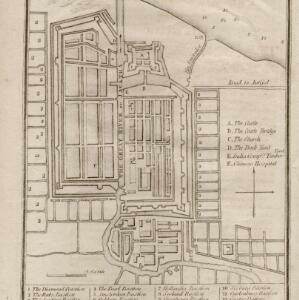
Batavia

event1812

location_onIndonesia

A plan of Batavia in the early 19th century, with the castle, church, dock yard, timber yard and hospital highlighted on the map’s legend. Also shown is the canal flowing through the city to the port, where the sea depth (‘soundings’) is indicated.

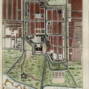
Grundris der stadt und citadelle Batavia

event1785

location_onIndonesia

A plan of the port of Batavia with a detailed legend identifying parts of the city. The sword and laurel wreath of the city’s coat of arms, and the Dutch East India Company flag (marked ‘VOC’ or ‘Vereenigde Oost Indische Compagnie’) are also shown.

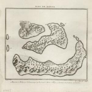
Iles de Banda

event1780

location_onIndonesia

Map of the Banda Islands—which was at this time the only source of nutmeg in the world—featuring mountains, plantations, settlements and a military fort. On the island of Gunnanapi (Banda Api) a volcano erupts (‘api’ means ‘fire’ in Indonesian).

close

  • Filter from 1623 to 1872

Current results range from 1623 to 1872