Search Results
Filter
Insets
Legend
Remove constraint Insets: Legend
Settlement Features
Kampong/Village
Remove constraint Settlement Features: Kampong/Village
Settlement Features
Post Office
Remove constraint Settlement Features: Post Office
Transport Hubs
Railway Station
Remove constraint Transport Hubs: Railway Station
Collections
Bodleian Libraries, University of Oxford
Remove constraint Collections: Bodleian Libraries, University of Oxford
3 Results found

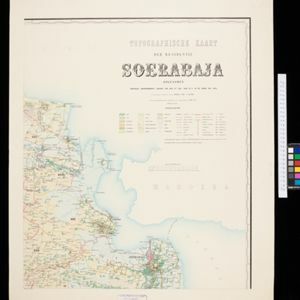
Topographische kaart der residentie Soerabaja
1895
Indonesia
The residency of Soerabaja, East Java, featuring crops (coffee, coconut, sugarcane, rice, alang-alang, bamboo) and fishing ponds. Three inset maps: a triangulation map; a map of distances between settlements by types of transport; Bawean Island.


