Search

Search Results

Algemeene Kaart van Nederlandsch Oostindie

event1842

location_onEast Timor, Indonesia, Malaysia, Singapore

This detailed map of the Dutch East Indies in the mid-19th century is spread over eight sheets, plus a cover sheet showing the whole area. There are numerous inset maps of islands, bays, cities etc.

General-Karte von Mittleren Sumatra von Padang bis Singkel

event1847

location_onIndonesia

This map focuses on the mountain ranges along the west coast of central Sumatra. Military bases, post offices, villages, rivers and hot springs are also marked, and there are inset maps of the towns of Padang and Singkel (Singkil).

Map of Prince of Wales' Island or Pulo Penang and province Wellesley

event1853

location_onMalaysia

Map of the Penang Strait, including written instructions on how to navigate the strait. On land, areas of cultivation are marked, with a table listing acreage used for each crop. A boundary with Siam based on an 1831 treaty is also shown.
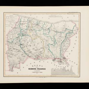
Kaart van de Residentie Pekalongan

event1854

location_onIndonesia

Map of the Dutch colonial administrative region (residency) of Pekalongan, Java, including an elevation showing the heights of the area’s mountains. (From ‘Algemeene Atlas van Nederlandsche Indie [General Atlas of the Dutch East Indies]’.)
Kaart van het Midden-en Zuidelyk Gedeelte van den Molukschen Archipel

event1854

location_onIndonesia, East Timor

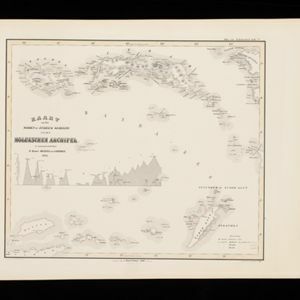
Map of some of the Maluku islands around the Banda Sea, colour-coded by their administrative region, and with an elevation showing heights of mountains. (From ‘Algemeene Atlas van Nederlandsche Indie [General Atlas of the Dutch East Indies]’.)

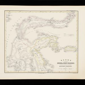
Kaart van Noord & Oost-Celebes, bevattende gedeelton der residentien Manado en Ternate

event1854

location_onIndonesia

Map of northern and eastern Celebes (Sulawesi) colour-coded by administrative region: the residencies of Manado (red borders) and Ternate (yellow borders). (From ‘Algemeene Atlas van Nederlandsche Indie [General Atlas of the Dutch East Indies]’.)
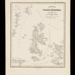
Kaart van Ternate, Halmaheira en Omringende Eilanden

event1854

location_onIndonesia

Map of Halmahera and other of the northern Maluku islands, colour-coded by their administrative region, with the seas and passages between them named. (From ‘Algemeene Atlas van Nederlandsche Indie [General Atlas of the Dutch East Indies]’.)
Kaart van de Residentie Kediri

event1855

location_onIndonesia

Map of the Dutch colonial administrative region (residency) of Kediri, Java. A list gives heights above sea level of some of the area’s mountains and villages. (From ‘Algemeene Atlas van Nederlandsche Indie [General Atlas of the Dutch East Indies]’.)

Kaart van de Residentie Bagelen

event1855

location_onIndonesia

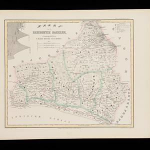
Map of the Dutch colonial administrative region (residency) of Bagelen, Java, including an elevation showing the heights of the area’s mountains. (From ‘Algemeene Atlas van Nederlandsche Indie [General Atlas of the Dutch East Indies]’.)

Kaart van het Regentschap Magelang

event1855

location_onIndonesia

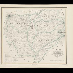
Map of the Dutch colonial administrative region (regency) of Magelang, Java, with a list of places—mountains, villages—with their height above sea level. (From ‘Algemeene Atlas van Nederlandsche Indie [General Atlas of the Dutch East Indies]’.)

Kaart van de Afdeeling Billiton (of Blitong)

event1856

location_onIndonesia

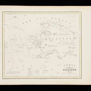
Map of the Dutch colonial administrative region of the island of Billiton (Belitung). The population is listed by race, and tin production by year. (From ‘Algemeene Atlas van Nederlandsche Indie [General Atlas of the Dutch East Indies]’.)

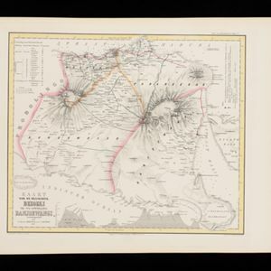
Kaart van de Residentie Bezoeki en de Afdeeling Banjoewangi

event1856

location_onIndonesia

Map of the Dutch colonial administrative regions of Bezoeki (Besuki) and Banjoewangi (Banyuwangi), on Java. Includes an elevation view of the mountains. (From ‘Algemeene Atlas van Nederlandsche Indie [General Atlas of the Dutch East Indies]’.)
close

  • Filter from 1842 to 1899

Current results range from 1842 to 1899