Search

Search Results

British Burma, Pegu division: With additions to railways up to 1891

event1891

location_onMyanmar

Topographical map of the Pegu Division of British Burma (Myanmar), spread over four sheets. In addition to mountains, forests, rivers and wetlands, rice fields, routes (road, railway, path, telegraph), villages and pagodas are marked.

Military cantonments: town and suburbs of Akyab, 1853-54

event1866

location_onMyanmar

Plan of British military installations in the port town of Akyab, Burma (Sittwe, Myanmar), featuring piers on the Kolladyne River (Kaladan River), hospitals, a work house, mission house, hotel, bazaar, burial grounds, religious buildings etc.

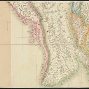
Map of the Eastern Frontier of British India, with the adjacent countries

event1838

location_onMyanmar, Thailand

Regional and local borders are colour-coded, with mountains and rivers, settlements, paths/roads and names of local peoples marked. Notes such as ‘Gold dust found in these streams’ and ‘Rich in Tin’ add detail. Only two of four sheets are available.

close

  • Filter from 1838 to 1891

Current results range from 1838 to 1891