Sketch map shewing the rivers and an outline of the coast... Gulf of Papua, British New Guinea
event1893
location_onPapua New Guinea
Sketch map of the head of Collingwood Bay
event1892
location_onPapua New Guinea
Sketch map shewing the rivers and an outline of the coast... Gulf of Papua, British New Guinea
event1892
location_onPapua New Guinea
Rough Sketch of 200 miles of the western portion of British New Guinea, including rivers
event1890
location_onPapua New Guinea
Sketch Map of Mai Cussa or Baxter River, and Wasu Cussa or Chester River, with their tributaries
event1888
location_onPapua New Guinea
Asiatic archipelago
event1876
location_onVietnam, Myanmar, Papua New Guinea, Philippines, Singapore, Southeast Asia, Thailand, Malaysia, Laos, Indonesia, East Timor, Cambodia, Brunei
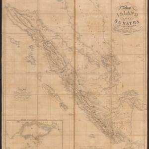
Map of the island of Sumatra constructed chiefly from surveys taken by order of the late Sir Thos. Stamford Raffles
event1829
location_onIndonesia, Malaysia, Singapore
A map of Java: chiefly from surveys made during the British administration
event1817
location_onIndonesia
A map of Java: chiefly from surveys made during the British administration
event1817
location_onIndonesia
Chart of Pulo Penang: now Prince of Wales's Island
event1805
location_onMalaysia
Chart of Pulo Penang: now Prince of Wales's Island