Search

Search Results

Topographische kaart de residentie Rembang

event1881

location_onIndonesia

Four-sheet topographic map of the residency of Rembang (Central Java) divided into regencies (pink borders) and districts (yellow borders). Crops—coconut, rice, coffee, bamboo, alang-alang, sugarcane—as well as salt pans and fishing ponds are shown.

[Schetskaarten van versterkingen, loopgraven, stellingen, bentengs e.d. uit de Atjeh oorlog]

event1880

location_onIndonesia

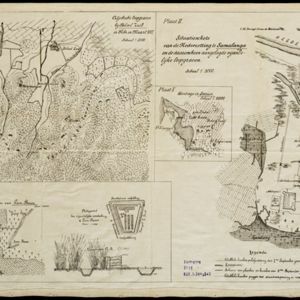
Multiple maps from the Aceh War, spread over 12 sheets. Includes maps of fortifications, trenches, battle formations; building plans, including the Aceh Sultan’s palace; topographic maps; and drawings of a ‘kotta mara’ (fortified raft).

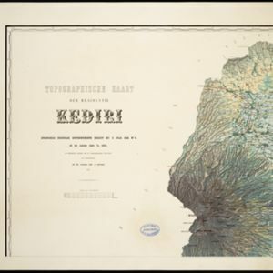
Topographische kaart der residentie Kediri

event1879

location_onIndonesia

Four-sheet topographic map of the residency of Kediri (East Java), divided into regencies (pink borders) and districts (yellow borders). Mountains, forests, settlements, routes and crops—sugarcane, alang-alang, rice, coffee, sugar, nutmeg—are shown.

Kaart van Groot-Atjeh

event1878

location_onIndonesia

This map of Groot-Atjeh (Aceh, northern Sumatra) focuses on the area in and around the city of Kota Radja (Banda Aceh) during the Aceh War. It shows current and former Dutch military fortifications, inhabited and abandoned villages, and rice paddies.

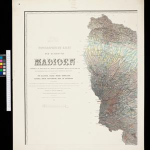
Topographische kaart der residentie Madioen

event1878

location_onIndonesia

Four-sheet topographic map of the mountainous residency of Madioen (Madiun, East Java), divided into regencies (pink borders) and districts (yellow borders). Crops—sugarcane, alang-alang, rice, coffee—sugar factories and coffee warehouses are shown.

Schetskaart van het N.W. gedeelte der Residentie Sumatra's Oostkust

event1877

location_onIndonesia

Rivers and crops are the focus of this map of the northeast coast of Sumatra. Forests and wetlands are marked, as are alang-alang, coconut, pepper, nutmeg and tobacco. Roads are shown as suitable for infantry and light artillery, or for horse riding.

Schetskaart van de Reede van Analaboe en aangrenzende landstreek

event1877

location_onIndonesia

Hand-drawn map of the roadstead—a body of water sheltered from tides/currents, for ships to anchor—at Analaboe (Meulaboh) on the west coast of northern Sumatra. Bathymetry (sea depth), shoals and reefs, and an anchor point are marked.

Topographische kaart der residentie Krawang

event1877

location_onIndonesia

The residency of Krawang (Karawang), West Java, featuring plantations (coffee, coconut, cinnamon, nutmeg, sugar); crops (rice, alang-alang, bamboo); post offices, routes (road, postal, canals), administrative borders; mountains, rivers, forests.

Topographische kaart der residentie Cheribon

event1877

location_onIndonesia

Six-sheet topographic map of the residency of Cheribon (Cirebon, West Java), with an inset of a geodesic triangle grid. Administrative districts, crops—rice, alang-alang, sugarcane, sugar, coffee, tea—and indigo plant mills are shown.

Kaart van het Rijk Deli

event1876

location_onIndonesia

Rivers and crops are the focus of this map of Deli (east coast of Sumatra). Forests and wetlands are marked, as are alang-alang, coconut, pepper, nutmeg and tobacco. Roads are shown as suitable for infantry and light artillery, or for horse riding.

Situatie kaart van een gedeelte der stad Batavia

event1874

location_onIndonesia

Map of the coastline of the bay of Batavia (Jakarta) showing the extension of the port’s pier (in red, labelled CD), the sand and mud bank and bathymetry (sea depth) in the bay, and notes regarding changes in tide levels over the years.

close