Search

Search Results

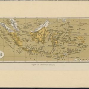
Oost-Indie

eventc.1867

location_onBrunei, Cambodia, East Timor, Indonesia, Laos, Malaysia, Myanmar, Philippines, Singapore, Southeast Asia, Thailand, Vietnam

Map of the East Indies in the mid-19th century, with Dutch colonial territory (Dutch East Indies) coloured in brown. Dutch administrative regions—such as residencies (‘residentie’) and governorates (‘gouvernement’)—are labelled.
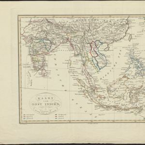
Kaart van Oost Indiën: behoorende bij Olivier Land- en zeetogten

event1830

location_onBrunei, Cambodia, East Timor, Indonesia, Laos, Malaysia, Myanmar, Philippines, Singapore, Southeast Asia, Thailand, Vietnam

Map from Johannes Olivier’s book ‘Land- en Zeetogten in Nederland's Indie [Land and Sea Journeys in the Dutch Indies]’, showing European colonial possessions and indigenous kingdoms in Asia.

Nieuwe en Naukeurige Kaart der Oost-Indische Eilanden

event1774

location_onBrunei, Cambodia, East Timor, Indonesia, Laos, Malaysia, Myanmar, Philippines, Singapore, Southeast Asia, Thailand, Vietnam

Some regions on this map of Southeast have a descriptive label: New Guinea is described as unknown to Europeans; Borneo was abandoned by Europeans due to the ‘unmanageability’ of the inhabitants; the Philippines were discovered by Spain in 1565.

Nieuwe en naukeurige kaart der Oost-Indische Eilanden

eventc.1770

location_onBrunei, Cambodia, East Timor, Indonesia, Laos, Malaysia, Myanmar, Philippines, Singapore, Southeast Asia, Thailand, Vietnam

Some regions on this map of Southeast have a descriptive label: Sumatra is described as having mines of gold, silver, iron, and sulphur; and elephants, tigers, rhinoceroses, dragons and crocodiles. Gilolo has rice, sago and turtles. Ambon has nutmeg.

close

  • Filter from 1770 to 1867

Current results range from 1770 to 1867