Search Results

Figuratieve kaart van de residentie Palembang
1885
Indonesia
A hand drawn map of the province of South Sumatra, divided into administrative districts, and including the capital city of Palembang. Mountains and rivers are featured prominently, with a list at the top left indicating the heights of the mountains.

Nederlandsch Oost-Indië
1865
Brunei, Cambodia, East Timor, Indonesia, Laos, Malaysia, Myanmar, Vietnam, Thailand, Southeast Asia, Singapore, Philippines, Papua New Guinea
This detailed map of the Dutch East Indies in the mid-19th century contains a great deal of information: topographical details, settlements and administrative areas, roads, railways and maritime routes, telegraph lines, inset maps etc.
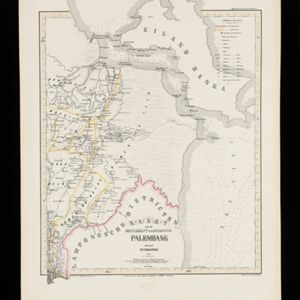
Kaart van de Oosterhelft der Residentie Palembang
1860
Indonesia
Map of the eastern half of the Dutch colonial administrative region (residency) of Palembang, Sumatra. A fort is marked in the town of Batoeradja. (From ‘Algemeene Atlas van Nederlandsche Indie [General Atlas of the Dutch East Indies]’.)

Kaart van de Nederlandsche bezittingen in Oost-Indië
1840
Brunei, East Timor, Indonesia, Malaysia, Philippines, Singapore
This map shows the Dutch colonial possessions in the East Indies in the mid-19th century. The text provides great detail about the people, religion, crops, animals, geography and administration of the Dutch East Indies.

Algemeene kaart van Nederlandsch Oostindie
c.1839-1855
East Timor, Indonesia, Malaysia, Singapore
This map of the Dutch East Indies is spread over eight sheets, with a hand-drawn cover sheet showing the whole area. There are numerous inset maps of islands, bays, cities etc. Two of the inset maps have a replacement map pasted over them.
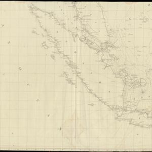
[Sumatra and the Strait of Malacca]
c.1800
Malaysia, Singapore, Indonesia
Chart of maritime Southeast Asia, showing bathymetry (sea depth), islands, shoals, reefs, landmarks, and notes (‘Rock seen at Low Water’), all to aid navigation. A rhumbline network has been drawn on the map in pencil. Only one sheet is present.


