
Search Results
Filter
Land Features
Mountain/Volcano
Remove constraint Land Features: Mountain/Volcano
Detailed Location
Malacca
Remove constraint Detailed Location: Malacca
Detailed Location
Sumatra
Remove constraint Detailed Location: Sumatra
Simple Location
Brunei
Remove constraint Simple Location: Brunei
Sea Features
Shoal
Remove constraint Sea Features: Shoal
Collections
National Library Board Singapore
Remove constraint Collections: National Library Board Singapore
31 Results found


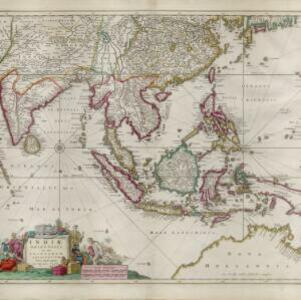
A map of the East-Indies and the adjacent countries: with the settlements, factories and territories, explaining what belongs to England, Spain, France, Holland, Denmark, Portugal &c.
1717
Brunei, Cambodia, East Timor, Indonesia, Laos, Malaysia, Myanmar, Philippines, Singapore, Southeast Asia, Thailand, Vietnam

- [remove]Brunei31
- Indonesia31
- Malaysia31
- Singapore31
- Cambodia30
- Thailand30
- Southeast Asia28
- Vietnam28
- East Timor27
- Laos27
- Myanmar27
- Philippines27
- Borneo31
- [remove]Malacca31
- [remove]Sumatra31
- Java28
- Sulawesi28
- Celebes26
- Malay Peninsula24
- Pegu21
- Siam21
- Western New Guinea15
- Insulae Philippinae14
- Iava13
- more Detailed Location »
- [remove]Mountain/Volcano31
- Jungle/Wooded Area16
- Wild Animals10


