Search

Search Results

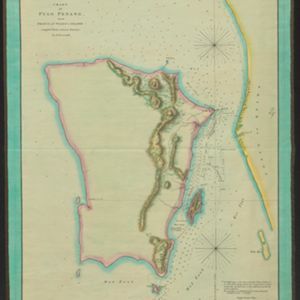
Chart of Pulo Penang: now Prince of Wales's Island

event1805

location_onMalaysia

Map focusing on the passage between Penang Island and the mainland, with shoals and reefs marked and described, and bathymetry (sea depth) shown. There are anchor points at George Town harbour, and landmarks—hills, trees, a fort—to aid navigation.
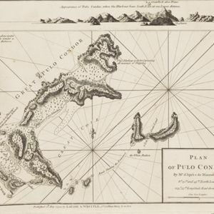
Plan of Pulo Condor

event1794

location_onVietnam

There is a port at the south of this map of the Côn Đảo archipelago (Vietnam), and notes giving details such as a suitable location to careen ships (turning a ship on its side for cleaning or repair). A ruined English fort is also marked.

Plan of the road and city of Batavia on the north coast of Java Island

event1790

location_onIndonesia

Map of the Batavia (Jakarta) Bay roadstead, a body of water sheltered from tides/currents, for ships to anchor. The web of lines is a rhumbline network, the numbers indicate sea depth (bathymetry), and there are written notes, all to aid navigation.

close

  • Filter from 1790 to 1805

Current results range from 1790 to 1805