Search

Search Results

Map of the Burman Empire including also Siam, Cochin-China, Ton-king and Malaya

event1842

location_onVietnam, Myanmar, Malaysia, Indonesia, Thailand, Laos, Cambodia, Brunei, Singapore

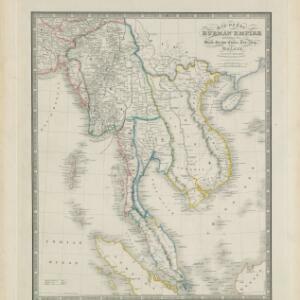
Regional borders are colour-coded on this mid-19th century map of mainland Southeast Asia, with British colonial territory in red (including part of the Burman Empire, the Straits Settlements, and Sarawak on Borneo).

Map of the Burman Empire including also Siam, Cochin-China, Ton-king and Malaya

eventc.1840-1852

location_onVietnam, Malaysia, Myanmar, Cambodia, Thailand, Laos, Singapore, Brunei

Although this mid-19th century map covers all of mainland Southeast Asia, the Burman Empire (Myanmar) is shown in greater detail, especially its districts, rivers and place names. It was produced by the James Wyld, geographer to Queen Victoria.

Isle de Baly = 'T eiland Baly

eventc.1772-1780

location_onIndonesia

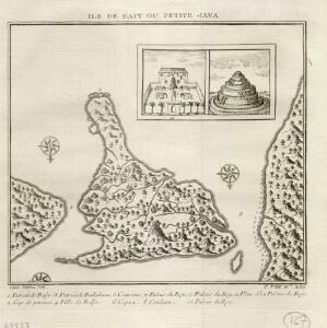
Amongst the mountains and jungles of mid-18th century Bali, this map shows three royal palaces, walled encampments, and seven Buddhist temples (or ‘stupa’) on the east coast. Inset illustrations depict a palace and a temple in detail.

Ile de Baly ou petite Java

event1770

location_onIndonesia

Amongst the mountains and jungles of mid-18th century Bali, this map shows three royal palaces, walled encampments, towns, and seven Buddhist temples (or ‘stupa’) on the east coast. Inset illustrations depict a palace and a temple in detail.

Das eyland Baly oder klein Java

event1750

location_onIndonesia

Amongst the mountains and jungles of mid-18th century Bali, this map shows three royal palaces, walled encampments, towns, and seven Buddhist temples (or ‘stupa’) on the east coast. Inset illustrations depict a palace and a temple in detail.

Ware affbeeldinge wegens het casteel ende stadt Batavia gelegen opt groot eylant Java anno 1669

event1670

location_onIndonesia

A plan of the important port of Batavia (Jakarta), with the fort, river, city streets and fields. Decorative illustrations include ships in the harbour, a view of the city and mountains, and the city’s coat of arms: a lion holding a sword and shield.

Baly

event1616

location_onIndonesia

This early 17th century map of the island of Bali shows palaces, settlements and possibly some temples. Ships can be seen at anchor around the coast. The map is from a Latin language book which includes text describing Bali.

close

  • Filter from 1616 to 1842

Current results range from 1616 to 1842