Search

Search Results

Asia: ex magna orbis terre descriptione Gerardi Mercatoris desumpta, studio & industria G.M. Iunioris

event1630

location_onBrunei, Cambodia, East Timor, Indonesia, Laos, Malaysia, Myanmar, Philippines, Singapore, Southeast Asia, Thailand, Vietnam

Originally published in Gerardus Mercator's ‘Atlas Sive Cosmographicae Meditationes de Fabrica Mundi et Fabricati Figura’ (1595), the title of which was the first use of the word ‘atlas’ to refer to a collection of maps. This is a 1630 reprint.

India orientalis

event1630

location_onBrunei, Cambodia, Indonesia, Laos, Malaysia, Myanmar, Philippines, Singapore, Southeast Asia, Thailand, Vietnam

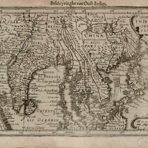
Four long rivers flow south through mainland Southeast Asia on this map: the ‘Menan’, ‘Manthabam’ and ‘Cosmin’ originate at a mythical lake (‘Chiamai Lacus’) in southern China, while the ‘Mecon’ (Mekong) flows from the hills of Cochinchina (Vietnam).

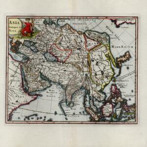
Asia antiqua et nova

eventc.1624-1700

location_onBrunei, Cambodia, Indonesia, Laos, Malaysia, Myanmar, Philippines, Singapore, Southeast Asia, Thailand, Vietnam

This 17th century map of Asia features a colourful painting of an Asian man wearing bright red robes and a feathered headdress. A parrot perches on his chair, while a large cat-like creature crouches menacingly by his side.

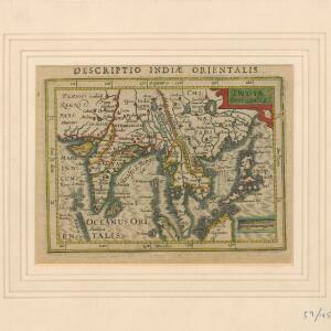
Descriptio Indiæ orientalis

event1607

location_onBrunei, Cambodia, Indonesia, Laos, Malaysia, Myanmar, Philippines, Singapore, Southeast Asia, Thailand, Vietnam

This early 17th century map features a number of mythical lakes that were once thought to exist in southern China. One of these lakes feeds three rivers—labelled ‘Menam’, ‘Manthabam’ and ‘Cosmin’—which flow south through mainland Southeast Asia.

India orientalis

eventc.1600-1699

location_onVietnam, Myanmar, Malaysia, Philippines, Singapore, Southeast Asia, Thailand, Laos, Indonesia, Cambodia, Brunei

This 17th century map features a number of mythical lakes once thought to exist in southern China. One of these lakes (‘Chiamai Lac’) feeds three rivers—labelled ‘Menan’, ‘Manthabam’ and ‘Cosmin’—which flow south through mainland Southeast Asia.

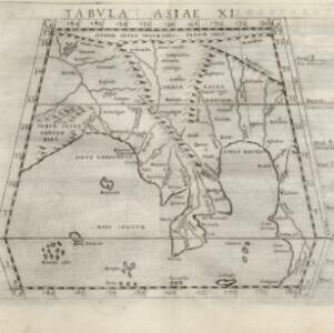
Tabvla Asiae XI

event1574

location_onCambodia, Indonesia, Malaysia, Laos, Myanmar, Singapore, Thailand, Vietnam, Southeast Asia

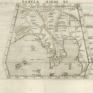
Mid-16th century map by Girolamo Ruscelli, based on the work of 2nd century geographer Ptolemy. It is difficult to pinpoint exact locations, but the Malay Peninsula is recognisable. Italian text on the reverse describes the region.

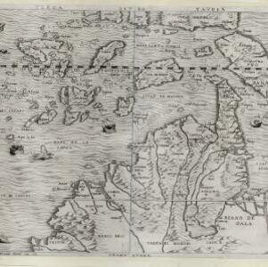
Terza Tavola

event1565

location_onBrunei, Cambodia, East Timor, Indonesia, Laos, Malaysia, Myanmar, Philippines, Singapore, Southeast Asia, Thailand, Vietnam

South is orientated towards the top of this map, with maritime Southeast Asia in the upper half and the mainland below. Top right is Java (‘Iava Magiore [Java Major]’); Borneo is labelled ‘Iava Menore [Java Minor]’. Ships and sea monsters are at sea.

Tabvla Asiae XI

event1561

location_onCambodia, Indonesia, Malaysia, Laos, Myanmar, Singapore, Thailand, Vietnam, Southeast Asia

Mid-16th century map by Girolamo Ruscelli, based on the work of 2nd century geographer Ptolemy. It is difficult to pinpoint exact locations, but the Malay Peninsula is recognisable. Italian text on the reverse describes the region.

Tabvla Asiae XI

eventc.1542-1552

location_onCambodia, Indonesia, Malaysia, Myanmar, Singapore, Thailand, Vietnam, Southeast Asia

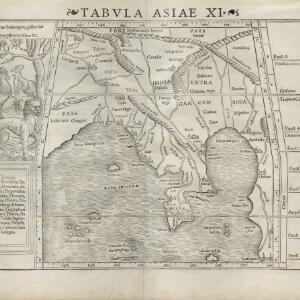
Early map by Sebastian Münster, based on the work of 2nd century geographer Ptolemy. The Malay Peninsula—labelled ‘Aurea Chersonesus [Golden Chersonese]’—is recognisable. An illustration shows the local animals: a tiger, cockerels and a white parrot.

Tabvla XI Asiae

event1522

location_onCambodia, Indonesia, Laos, Malaysia, Myanmar, Singapore, Thailand, Vietnam, Southeast Asia

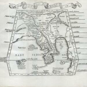
Early map by Lorenz Fries, based on the work of 2nd century geographer Ptolemy. The Malay Peninsula—labelled ‘Aurea Chersone [Golden Chersonese]’—is recognisable. A drawing on the reverse features cannibals with dog’s heads chopping up human bodies.

Vndecima Asiae Tabvla

event1513

location_onCambodia, Laos, Malaysia, Myanmar, Singapore, Thailand, Vietnam

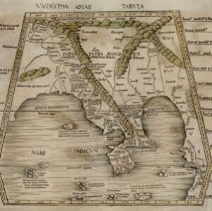
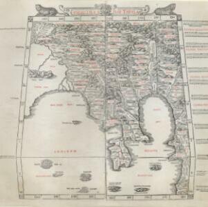
Based on the work of 2nd century geographer Ptolemy, this map by Martin Waldseemüller has Latin inscriptions. The Malay Peninsula is labelled ‘Aurea Chersones [Golden Chersonese]’.

Vndecima Asiae Tabvla

event1511

location_onCambodia, Laos, Malaysia, Myanmar, Singapore, Thailand, Vietnam

Based on the work of 2nd century geographer Ptolemy, Bernardo Silvani’s woodcut map is innovative in its use of two colours: a black background with important text added in red. The Malay Peninsula is labelled ‘Aurea Chersonesus [Golden Chersonese]’.

close