Search Results
Filter
Land Features
Mountain/Volcano
Remove constraint Land Features: Mountain/Volcano
Transport Hubs
Port
Remove constraint Transport Hubs: Port
120 Results found
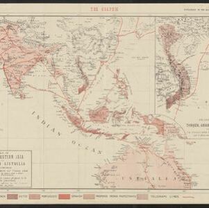
Map of South-Eastern Asia and Northern Australia: showing the districts in Annam and Tonquin which France proposes to annex and to place under a Protectorate, the portion of New Guinea proposed to be acquired by Queensland, and the districts affected by the volcanic eruptions in Java
1883
Southeast Asia, Singapore, Thailand, East Timor, Vietnam, Brunei, Cambodia, Indonesia, Laos, Malaysia, Myanmar, Papua New Guinea, Philippines
- Filter from 1596 to 1898
- [remove]Mountain/Volcano120
- Wetlands47
- Jungle/Wooded Area38
- Wild Animals17
- Mangrove8


