Search

Search Results

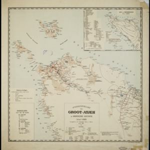
Overzichtskaart van Groot-Atjeh en aangrenzende kuststaten

event1898

location_onIndonesia

Map of Groot-Atjeh (Aceh, Sumatra), focusing on the area around the capital Kota Radja (Banda Aceh) and along the coasts. There is a list of telephone connections in the area, and an inset map of the region divided into administrative districts.

Atlas van Nederlandsch Oost-Indië

eventc.1897-1904

location_onIndonesia

Very detailed atlas of the entire Dutch East Indies, over 16 map sheets, with a cover and overview map. Includes topographic maps, inset maps of cities and islands, and maps featuring land and sea routes, languages, geology, colonial territory etc.

Oostkust Sumatra: Blad VII

event1896

location_onIndonesia

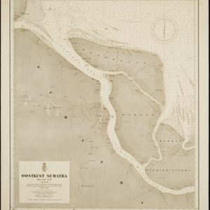
Navigation map of the waters around the islands of Bengkalis, Pedang and Tebingtinggi, off the east coast of Sumatra. Bathymetry (sea depth), tide data, reefs, shoals and other obstructions (clay, mud, shells, sand) are marked.

Koninginne baai met Emma haven

event1894

location_onIndonesia

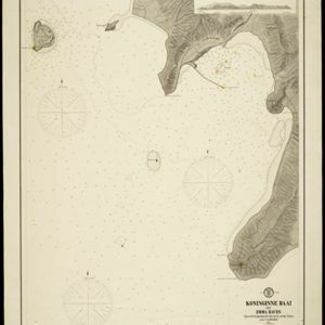
Map of Koninginne Baai (Bayur Bay, west coast of Sumatra) used to navigate Emma Haven (now Port of Teluk Bayur). It features bathymetry (sea depth), reefs and shoals, as well as lighthouses, buoys and two elevations (side views) of coastal mountains.

Sumatra

event1889

location_onIndonesia

Map of the city of Padang on the west coast of Sumatra, with inset maps of the nearby islands, featuring residential, business, government and military areas. There are also agricultural areas with coconut, nutmeg, bamboo, nipa palm and sago palm.

Overzichtskaart van Groot-Atjeh

event1884

location_onIndonesia

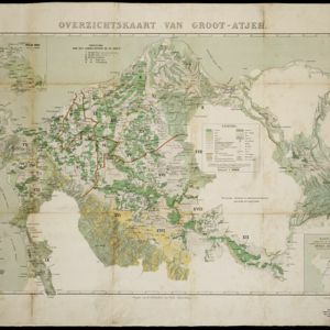
Map of Groot-Atjeh (Aceh, Sumatra) divided into administrative districts. Mountains, forests, villages, railways, roads and rivers are marked. There are inset maps of Poeloe Bras (Breueh Island), and showing distances between larger settlements.
Tocht van de expeditie kolonne over Seglie naar Telok Kadjoe van 6-24 Mei 1878

event1879

location_onIndonesia

Map of a Dutch military expedition from Seglie (Sigli) on the northeast coast of Sumatra to Telok Kadjoe, during the Aceh War between Aceh and Dutch colonists. They land at Sigli and cross marshland, high grass, and rice and sugarcane fields.

Nederlandsch Oost-Indië

event1865

location_onBrunei, Cambodia, East Timor, Indonesia, Laos, Malaysia, Myanmar, Vietnam, Thailand, Southeast Asia, Singapore, Philippines, Papua New Guinea

This detailed map of the Dutch East Indies in the mid-19th century contains a great deal of information: topographical details, settlements and administrative areas, roads, railways and maritime routes, telegraph lines, inset maps etc.

Kaart van de Gouvernement Sumatra's Westkust No. 1

event1857

location_onIndonesia

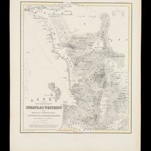
Map of part of the Dutch colonial administrative region of Sumatra’s Westkust (Sumatra’s West Coast). A route into the port of Sibogha (Sibolga) is marked. (From ‘Algemeene Atlas van Nederlandsche Indie [General Atlas of the Dutch East Indies]’.)

Algemeene Atlas van Nederlandsche Indie

eventc.1853-1862

location_onIndonesia

Atlas featuring over 60 detailed maps of the Dutch East Indies: 24 maps cover Java; the remainder cover the rest of the Dutch East Indies. There are three index maps. (All the maps in this atlas are also presented separately on this platform.)

Algemeene Kaart van Nederlandsch Oostindie

event1842

location_onEast Timor, Indonesia, Malaysia, Singapore

This detailed map of the Dutch East Indies in the mid-19th century is spread over eight sheets, plus a cover sheet showing the whole area. There are numerous inset maps of islands, bays, cities etc.

Algemeene kaart van Nederlandsch Oostindie

eventc.1839-1855

location_onEast Timor, Indonesia, Malaysia, Singapore

This map of the Dutch East Indies is spread over eight sheets, with a hand-drawn cover sheet showing the whole area. There are numerous inset maps of islands, bays, cities etc. Two of the inset maps have a replacement map pasted over them.

close

  • Filter from 1815 to 1898

Current results range from 1815 to 1898