Search

Search Results

Kaart der Molukken

event1898

location_onIndonesia, East Timor

Map of the Moluccas (Maluku Islands) divided into the residencies of Ternate (orange borders) and Ambon (green borders). Many place names are in Dutch and Malay, and there is an inset map of the city of Ambon. Timor is marked as Portuguese territory.

City of Mandalay and environs

event1894

location_onMyanmar

Map of the Burmese city of Mandalay on the Irrawaddy River. The city has a grid of roads and buildings, dominated by Fort Dufferin (formerly Mandalay Palace). The surrounding country has villages, crops, agricultural ponds and irrigation channels.

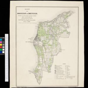
Kaart van Makassar en Omstreken

event1894

location_onIndonesia

Map of the city of Makassar, Celebes (Suawesi), with the Dutch Fort Rotterdam, Koning’s Plein (King's Square) and a military hospital. The surrounding area has villages and crops: rice (paddy) fields, coconut, bamboo, nipa palm, banana.

Singapore: Plan of harbour and roadstead

event1885

location_onSingapore

Plan of Singapore harbour, with wharfs and buildings. A roadstead—a body of water sheltered from tides/currents, for ships to anchor—is labelled ‘Singapore Road’. Islands, shoals and reefs are marked, as are roads and buildings in the city.

Algemeene Kaart van Nederlandsch Oostindie

event1842

location_onEast Timor, Indonesia, Malaysia, Singapore

This detailed map of the Dutch East Indies in the mid-19th century is spread over eight sheets, plus a cover sheet showing the whole area. There are numerous inset maps of islands, bays, cities etc.

close

  • Filter from 1842 to 1898

Current results range from 1842 to 1898