Search

Search Results

Insulae Iavae pars Occidentalis

eventc.1710-1719

location_onIndonesia

A map of Java with mountains, jungles, animals and crops. Bathymetry (sea depth) is marked, including on an inset map of Batavia harbour. Illustrations include Batavia Castle, and a lion—representing Belgium—receiving tribute and enslaving locals.

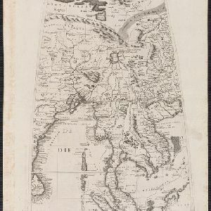
[Globe gore covering Asia]

eventc.1693-1707

location_onMalaysia, Cambodia, Indonesia, Laos, Myanmar, Singapore, Thailand, Vietnam

On this map, ‘Lago di Chiamay’, one of number of mythical lakes once thought to exist in southern China, feeds five rivers—labelled ‘Menam’, ‘Pegu’ ‘Maraban’, ‘Cosmin’ and ‘Caor’—which flow south through mainland Southeast Asia.

close

  • Filter from 1693 to 1710

Current results range from 1693 to 1710