Search

Search Results

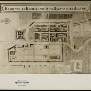
Kaart van het kasteel en de stad Batavia in het jaar 1667

event1898

location_onIndonesia

Very detailed map of the port city of Batavia (Jakarta), with numerous locations listed in the multiple legends. The city’s coat of arms—featuring a sword and laurel wreath—and the Dutch East India Company monogram logo—letters ‘VOC’—are also shown.

Atlas van Nederlandsch Oost-Indië

eventc.1897-1904

location_onIndonesia

Very detailed atlas of the entire Dutch East Indies, over 16 map sheets, with a cover and overview map. Includes topographic maps, inset maps of cities and islands, and maps featuring land and sea routes, languages, geology, colonial territory etc.

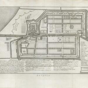
Batavia

eventc.1772-1780

location_onIndonesia

A plan of the port city of Batavia in the 18th century. Small ships can be seen transporting goods along the river to the pier, and the street plan also includes churches, shopping areas and hospitals, as noted on the map’s detailed legend.

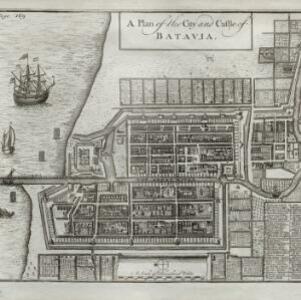
A plan of the city and castle of Batavia

event1746

location_onIndonesia

A mid-18th century plan of Batavia (Jakarta), the main port of the Dutch East India Company's trading network in Southeast Asia. Ships can be seen transporting goods along ‘The Great River’ to the sea, overseen by Batavia Castle at the river’s mouth.

close

  • Filter from 1746 to 1898

Current results range from 1746 to 1898