Search Results
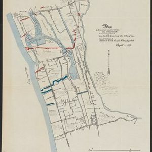
Map of the Spanish and American trenshes on the south of Manila
c.1900-1909
Philippines
Created by the U.S. Army during the Spanish-American War, this reconnaissance map of a small area south of Manila features Spanish (red) and American (blue) trenches, as well as roads, buildings and ground conditions (firm ground, swamps, fields).

Kaart van het gebied bezet in Groot-Atjèh
1898
Indonesia
A six-sheet map of Groot-Atjèh (Aceh, northern Sumatra) focusing on areas occupied during the Aceh War (1873–1904) between the Sultanate of Aceh and Dutch colonists. It shows military positions and fortifications, buildings, routes and crops.
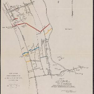
Copy of map furnished to commanding officers, 2nd Brig., 2nd Div., 8th Army Corps, on August 12, 1898
1898
Philippines
Created by the U.S. Army during the Spanish-American War, this reconnaissance map of a small area south of Manila features Spanish (red) and American (blue) trenches, as well as roads, buildings and ground conditions (firm ground, swamps, bamboo).
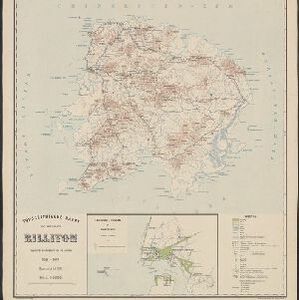
Topographische kaart van het eiland Billiton: vluchtig opgenomen in de jaren 1877-1878
1894
Indonesia
This map of the island of Billiton (Belitung, Indonesia) features mountains, rivers, railways, roads, settlements, coconut plantations and administrative borders. An inset map shows the island’s port and capital city Tanjung Pandan.
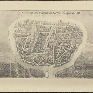
Afbeldinge der Stadt Iudiad hooft des choonincrick Siam
1665
Thailand
Map of the Siamese city of Ayutthaya (‘Iudiad’) represented pictorially, surrounded by rivers and with a grid-like layout of roads, rivers and buildings. The city existed from 1350 until 1767 when it was destroyed by an invading Burmese force.


