Search

Search Results

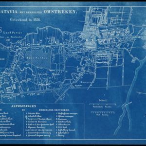
De stad Batavia met derzelver omstreken: Geteekend in 1826

event1898

location_onIndonesia

The city of Batavia (Jakarta) with its port and castle is to the north (right side of the map). Koningsplein (Merdeka Square), a large area of rice paddies, graveyards and villages can be seen to the south (left). Copied from a c.1826 map.

Atlas van Nederlandsch Oost-Indië

eventc.1897-1904

location_onIndonesia

Very detailed atlas of the entire Dutch East Indies, over 16 map sheets, with a cover and overview map. Includes topographic maps, inset maps of cities and islands, and maps featuring land and sea routes, languages, geology, colonial territory etc.

Plan of the town and suburbs of Rangoon

eventc.1895-1897

location_onMyanmar

Detailed plan of the city of Rangoon (Yangon, Myanmar) with commercial, religious, government and military buildings, surrounded by lakes, fields of crops and villages. Someone has drawn details on the map of areas that have undergone ‘levelling’.

Plattegrond der stad Batavia

event1866

location_onIndonesia

A mid-19th century map of the important port of Batavia (Jakarta), with its pier, commercial centre and residential streets. However, the city is also surrounded by villages (kampongs), fields and plantations. An inset map shows Batavia Castle.

Judia

event1729

location_onThailand

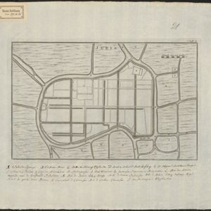
Map of the rivers, roads and canals of Judia (city of Ayutthaya). The legend includes a palace, elephant enclosures, Archbishop’s church and palace. Outside are residential areas for people from Portugal, Japan, Pegu, Malaya, China and Cochinchina.

Judia

event1729

location_onThailand

Map of the rivers, roads and canals of Judia (city of Ayutthaya). The legend includes a palace, elephant enclosures, Archbishop’s church and palace. Outside are residential areas for people from Portugal, Japan, Pegu, Malaya, China and Cochinchina.

close

  • Filter from 1729 to 1898

Current results range from 1729 to 1898