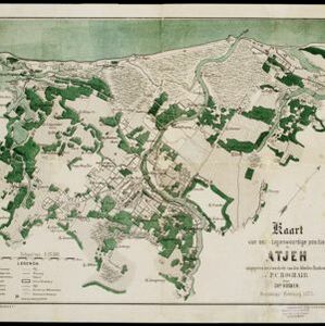
Search Results


Kaart van het terrein des oorlogs in Groot-Atjeh
1883
Indonesia
The Aceh War (1873–1904) between the Sultanate of Aceh and Dutch colonists is highlighted on this map of Groot-Atjeh in 1876. Flag symbols mark the locations of Dutch military posts, and some villages are described as ‘verbrande [burnt]’.

Kaart van het terrein des oorlogs in Groot-Atjeh in 1876
1883
Indonesia
The Aceh War (1873–1904) between the Sultanate of Aceh and Dutch colonists is highlighted on this map of Groot-Atjeh in 1876. Flag symbols mark the locations of Dutch troops, while a red line records the route marched by ‘agitating troops’ in 1875-6.

Kaart van het terrein des Oorlogs in Groot-Atjeh in 1876
1883
Indonesia
The Aceh War (1873–1904) between the Sultanate of Aceh and Dutch colonists is highlighted on this map of Groot-Atjeh in 1876. Flag symbols mark the locations of Dutch troops, while a red line records the route marched by ‘agitating troops’ in 1875-6.

Tocht van de expeditie kolonne over Seglie naar Telok Kadjoe van 6-24 Mei 1878
1879
Indonesia
Map of a Dutch military expedition from Seglie (Sigli) on the northeast coast of Sumatra to Telok Kadjoe, during the Aceh War between Aceh and Dutch colonists. They land at Sigli and cross marshland, high grass, and rice and sugarcane fields.