Search

Search Results

Topographische kaart der residentie Semarang

event1898

location_onIndonesia

The residency of Semarang, Central Java, featuring crops (coffee, rice, bamboo, nipa palm); cemeteries, post offices, railway stations; routes (railway, postal, road, canal), administrative borders; mountains, rivers, forests.

[Batavia en omgeving]

event1898

location_onIndonesia

Four sheets from a larger series of maps, showing the city of Batavia (Jakarta, Java). The port, railway network and city centre are shown in great detail. To the west and south of the centre, there are villages, rice paddies, fields and wetlands.

Atlas van Nederlandsch Oost-Indië

eventc.1897-1904

location_onIndonesia

Very detailed atlas of the entire Dutch East Indies, over 16 map sheets, with a cover and overview map. Includes topographic maps, inset maps of cities and islands, and maps featuring land and sea routes, languages, geology, colonial territory etc.

Residentie Soerabaja

event1895

location_onIndonesia

There are 64 sheets of this very large-scale (1:20,000) topographic map of the regency of Soerabaja (East Java). Cities and villages, roads, railways and rivers, crops and many more features are all shown in great detail. First sheet is an overview.

Topographische kaart der residentie Soerabaja

event1895

location_onIndonesia

The residency of Soerabaja, East Java, featuring crops (coffee, coconut, sugarcane, rice, alang-alang, bamboo) and fishing ponds. Three inset maps: a triangulation map; a map of distances between settlements by types of transport; Bawean Island.

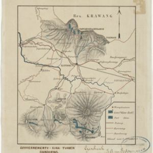
Topographische kaart van de residentie Preanger regentschappen

event1894

location_onIndonesia

The residency of Preanger (Parahyangan), West Java, with plantations (coconut, coffee, tea, cinchona (‘kina’), betel, teakwood, bamboo) and crops (rice, sugarcane, alang-alang). Two inset maps: a triangulation map, and a map of land route distances.

Kaart van der residentie Soerabaja

event1893

location_onIndonesia

A map of the residency of Soerabaja (East Java) divided into regencies, departments and districts. There are large fishing ponds around the coasts. An inset map shows distances between settlements by road, tracks and paths.

Kaart van de residentie Preanger regentschappen

event1893

location_onIndonesia

A map of the residency of Preanger (West Java) spread over three sheets and divided into regencies, departments and districts. An inset map shows distances between cities, towns and villages by road, tracks and paths.

Kaart van de Residentie Kediri

event1891

location_onIndonesia

A map of the residency of Kediri (East Java) divided into regencies, which are then subdivided into districts. Mountains, roads, railways and rivers are shown. An inset map shows distances between settlements by road, tracks and paths.

Topographische kaart der residentie Soerabaja

event1884

location_onIndonesia

The residency of Soerabaja, East Java, featuring crops (coffee, coconut, sugarcane, rice, alang-alang, bamboo) and fishing ponds. Three inset maps: a triangulation map; a map of distances between settlements by types of transport; Bawean Island.

Kaart van Malang en Omstreken

event1882

location_onIndonesia

Map of the city of Malang, Java, featuring the railway station, military camp, hospital, market etc. The surrounding area has villages, rivers and crops: rice (paddy) fields, coffee, alang-alang, bamboo. Red numbers represent height above sea-level.

Gouvernements-kina-tuinen, Bandoeng, Java

event1881

location_onIndonesia

This map of Bandung, Java, highlights areas used to cultivate the plant Cinchona (‘Kina’). Its bark produces quinine which was used to treat malaria. A railway line, postal routes, cart roads and bridleways are also shown.

close

  • Filter from 1866 to 1898

Current results range from 1866 to 1898