
Search Results
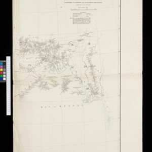

South eastern frontier
c.1890-1906
Myanmar, Thailand
Very detailed large-scale map of the southeast border of Burma (Myanmar) and Siam (Thailand), divided into districts. Spread over multiple sheets, seems incomplete (some sheets appear more than once, probably from different versions of the same map).

The external trade routes of India: with tables showing the amount and value of the principal exports and imports of the chief Indian sea ports and frontier states
1886
Myanmar, Thailand
This map of the trade routes of India includes Burma (Myanmar) and part of Siam (Thailand). The Rangoon and Irrawaddy Valley State Railway is marked. There are tables showing the values of imports and exports for each area, listed by produce type.

Burma: with parts of India, China, and Siam
1886
Myanmar, Laos, Thailand
Map of Burma labelled with indigenous peoples (uppercase red text) and products (salt, copper, tea, rubies, coal, rubber, petroleum, marble, jade, silver) of each area. It also marks two journeys by the explorer J. Annan Bryce, and proposed railways.


